CaliforniaTropicalCycloneBreakpoints.png
No higher resolution available.
Summary
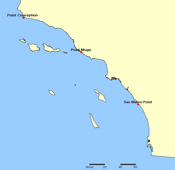
A map of breakpoints for w:tropical cyclones in California.
It is made using screenshots of online parts of the National Atlas of the United States. The screenshots are put together using MS Paint to make a map of breakpoints.
The screenshots were acquired from this site archive copy at the Wayback Machine , which is part of the National Atlas. The plotted locations were found by searching for them at the aforementioned site.
|
|
This map was obtained from an edition of the
National Atlas of the United States
. Like almost all works of the U.S. federal government, works from the
National Atlas
are in the
public domain
in the United States.
Online access: NationalAtlas.gov | 1970 print edition: Library of Congress , Perry-Castañeda Library
|
|
National Atlas Site archive copy at the Wayback Machine
-- wikipedia:en:user:Miss Madeline
| Description |
English:
Map of warning breakpoints.
Español:
Mapa de los puntos de rompimiento de aviso.
Simple English:
Map of warning stations.
|
||||||
| Date | |||||||
| Source | w:Image:CaliforniaTropicalCycloneBreakpoints.JPG | ||||||
| Author | wikipedia:en:user:Miss Madeline (original uploader) | ||||||
|
Permission
( Reusing this file ) |
|
||||||
| Other versions | w:Image:CaliforniaTropicalCycloneBreakpoints.JPG | ||||||
