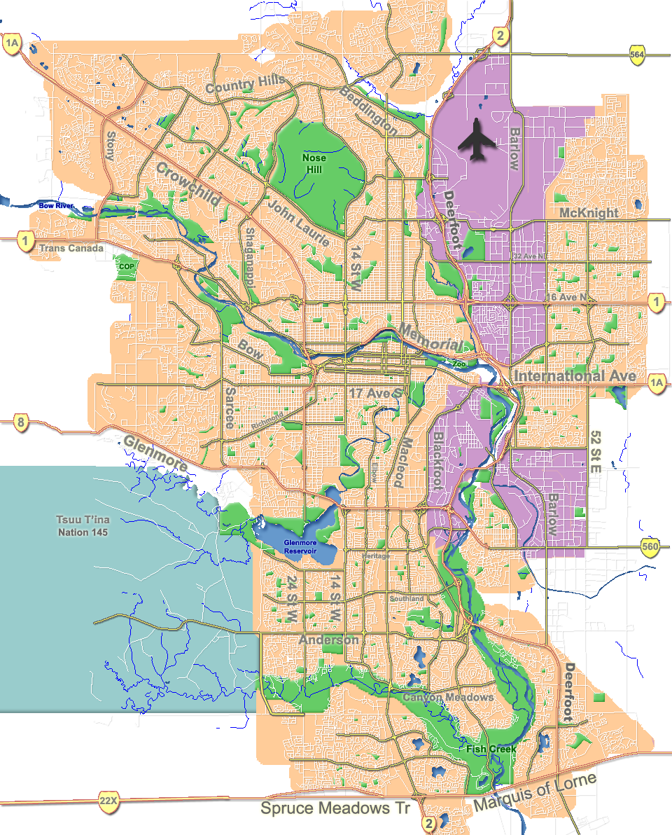
Calgary_street_map.png
Size of this preview:
483 × 600 pixels
.
Other resolutions:
193 × 240 pixels
|
386 × 480 pixels
|
960 × 1,192 pixels
.
Summary
| Description |
English:
Outline map of
Calgary
.
|
| Date | |
| Source | GIS data |
| Author | Qyd |
| Other versions |
Derivative works of this file: |
| Camera location |
|
View this and other nearby images on: OpenStreetMap |
|
|---|
Licensing
|
|
I, the copyright holder of this work, release this work into the
public domain
. This applies worldwide.
In some countries this may not be legally possible; if so: I grant anyone the right to use this work for any purpose , without any conditions, unless such conditions are required by law. |