CIA-TimorLeste.jpg

Size of this preview:
643 × 600 pixels
.
Other resolutions:
257 × 240 pixels
|
515 × 480 pixels
|
824 × 768 pixels
|
1,054 × 983 pixels
.
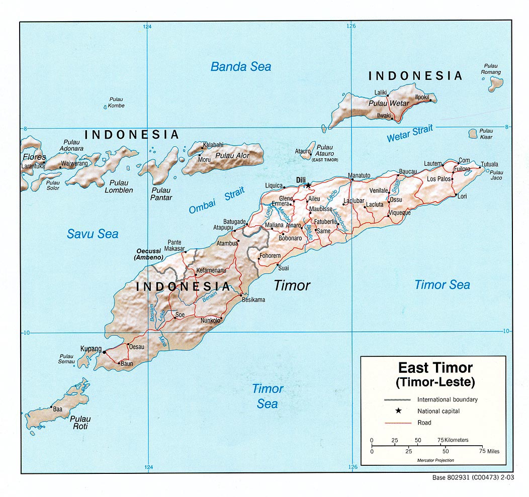
Summary
| Description |
English:
Map of
East Timor
(Timor-Leste).
|
| Date | |
| Source | East Timor (Shaded Relief) U.S. Central Intelligence Agency 2003 from Perry-Castañeda Library Map Collection: East Timor (Timor-Leste) Maps |
| Author | U.S. Central Intelligence Agency |
|
Permission
( Reusing this file ) |
Public domain |
Licensing
|
|
This image is a work of a
Central Intelligence Agency
employee, taken or made as part of that person's official duties. As a Work of the United States Government, this image or media is in the
public domain
in the United States.
|

|