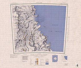
C81195s1_Ant.Map_Mount_Nares.jpg

Size of this preview:
711 × 600 pixels
.
Other resolutions:
285 × 240 pixels
|
569 × 480 pixels
|
910 × 768 pixels
|
1,214 × 1,024 pixels
|
2,428 × 2,048 pixels
|
3,845 × 3,244 pixels
.
| Description |
English:
Map of Antarctica by the United States Antarctic Resource Center of the US Geological Survey.
|
| Date | |
| Source | USGS |
| Author | United States Geological Survey |
|
|
This image is in the
public domain
in the United States because it only contains materials that originally came from the
United States Geological Survey
, an agency of the
United States Department of the Interior
. For more information, see
the official USGS copyright policy
.
|
|