Byzantine_empire_1355.jpg

Size of this preview:
758 × 600 pixels
.
Other resolutions:
304 × 240 pixels
|
607 × 480 pixels
|
971 × 768 pixels
|
1,134 × 897 pixels
.
Summary
| Description |
English:
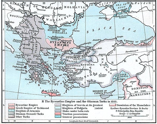
Map of the Byzantine, Ottoman and Serbian empires and their neighboring states, 1355.
|
||||||||||||||||||||||
| Date | |||||||||||||||||||||||
| Source | William R. Shepherd 's Historical Atlas , p. 89, published by Henry Holt and Company, New York 1911 | ||||||||||||||||||||||
| Author |
|
||||||||||||||||||||||
| Other versions |
|
||||||||||||||||||||||

Licensing
|
|
This work is in the
public domain
in the
United States
because it was
published
(or registered with the
U.S. Copyright Office
) before January 1, 1929.
Public domain works must be out of copyright in both the United States and in the source country of the work in order to be hosted on the Commons. If the work is not a U.S. work, the file
must
have an additional
copyright tag
indicating the copyright status in the source country.
Note: This tag should not be used for sound recordings. |