British_former_postal_counties_(numbered).svg

Size of this PNG preview of this SVG file:
400 × 600 pixels
.
Other resolutions:
160 × 240 pixels
|
320 × 480 pixels
|
512 × 768 pixels
|
682 × 1,024 pixels
|
1,365 × 2,048 pixels
|
690 × 1,035 pixels
.
Summary
| Description |
English:
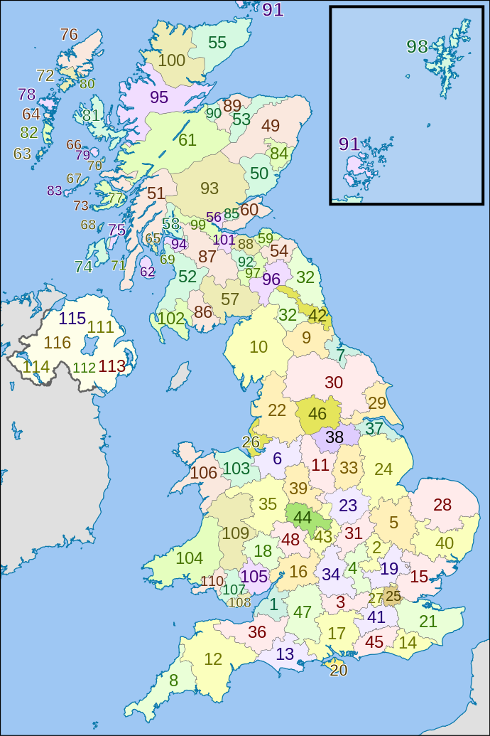
Map of Royal Mail
former postal counties of the United Kingdom
.
|
| Date | |
| Source |
This file was derived from:
|
| Author |
|


References
- Former postal county boundaries derived from List of postcode districts in the United Kingdom , revision as of 18:05, 5 September 2013.
Licensing
This file is licensed under the
Creative Commons
Attribution-Share Alike 3.0 Unported
license.
Attribution:
Richardguk and Dr Greg. Contains Ordnance Survey and Royal Mail data © Crown copyright and database right.
-
You are free:
- to share – to copy, distribute and transmit the work
- to remix – to adapt the work
-
Under the following conditions:
- attribution – You must give appropriate credit, provide a link to the license, and indicate if changes were made. You may do so in any reasonable manner, but not in any way that suggests the licensor endorses you or your use.
- share alike – If you remix, transform, or build upon the material, you must distribute your contributions under the same or compatible license as the original.