Bristol.svg

Size of this PNG preview of this SVG file:
791 × 600 pixels
.
Other resolutions:
317 × 240 pixels
|
633 × 480 pixels
|
1,013 × 768 pixels
|
1,280 × 970 pixels
|
2,560 × 1,941 pixels
|
1,364 × 1,034 pixels
.
| Description |
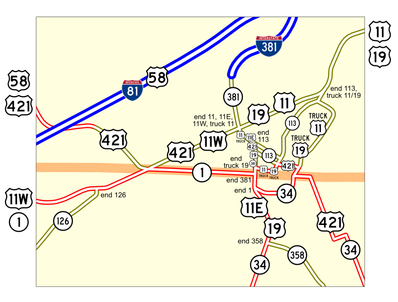
Map of numbered routes in Bristol, Tennessee-Virginia. Traced on USGS topos.
|
||
| Date | _2004. | ||
| Source | http://www.tdot.state.tn.us/ | ||
| Author | User:SPUI | ||
|
Permission
( Reusing this file ) |
|