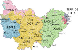
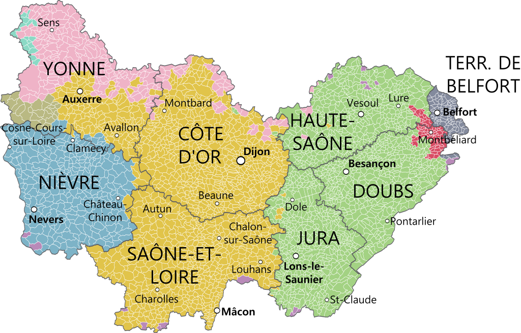
Bourgogne-Franche-Comté_et_provinces.svg

Size of this PNG preview of this SVG file:
800 × 512 pixels
.
Other resolutions:
320 × 205 pixels
|
640 × 409 pixels
|
1,024 × 655 pixels
|
1,280 × 819 pixels
|
2,560 × 1,638 pixels
|
1,574 × 1,007 pixels
.
Summary
| Description |
|
|||
| Date | ||||
| Source |
Gouvernemens généraux de la Marche, du Limousin, et de l'Auvergne et Gouvernements généraux du Berry, du Nivernois, et du Bourbonois , Robert de Vaugondy, 1753. ; Partie méridionale du gouvernement général de Bourgogne où se trouvent les bailliages d'Autun, et de Challon, le Mâconois, la Bressedivisés en leurs mandemens. Gouvernement general du Lyonois divisé en Lyonois, Forez et Beaujolois , Gouvernements généraux du Berry, du Nivernois, et du Bourbonois , Robert de Vaugondy, 1753 ; Partie méridionale du gouvernement général de Champagne qui comprend la Champagne propre, la Vallage, le Bassigny, le Senonois, et une partie de la Brie et du Perthois , Robert de Vaugondy. Derivative works of this file: Blank map of France, with communes and departments.svg by Poulpy |
|||
| Author | Oie blanche |
Licensing
I, the copyright holder of this work, hereby publish it under the following license:
This file is licensed under the
Creative Commons
Attribution-Share Alike 4.0 International
license.
-
You are free:
- to share – to copy, distribute and transmit the work
- to remix – to adapt the work
-
Under the following conditions:
- attribution – You must give appropriate credit, provide a link to the license, and indicate if changes were made. You may do so in any reasonable manner, but not in any way that suggests the licensor endorses you or your use.
- share alike – If you remix, transform, or build upon the material, you must distribute your contributions under the same or compatible license as the original.