Bonga_at_Wallsend_-_geograph.org.uk_-_1394541.jpg
No higher resolution available.
Summary
| Description |
English:
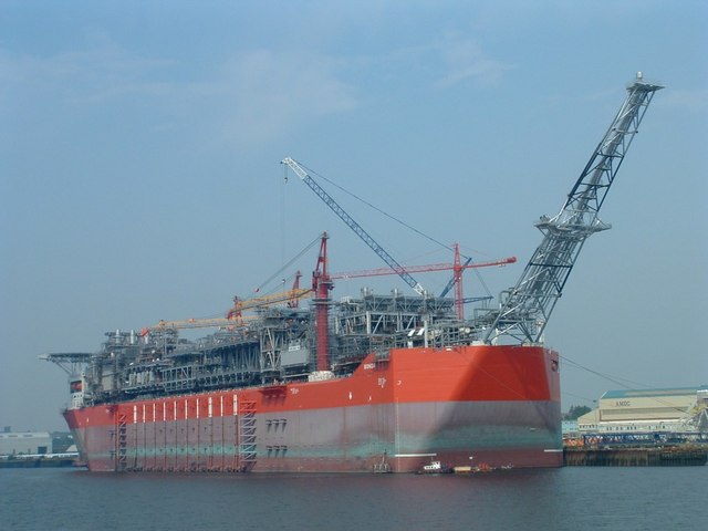
Bonga at Wallsend The 'Bonga' FPSO (Floating Production, Storage and Offloading vessel) being fitted out at the AMEC yard in Howdon, Wallsend
Picture taken from near the Pedestrian Tunnel across the Tyne in Jarrow
|
| Date | |
| Source | From geograph.org.uk |
| Author | Vin Mullen |
|
Attribution
( required by the license ) |
Vin Mullen / Bonga at Wallsend / |
| Camera location |
|
View this and other nearby images on: OpenStreetMap |
|
|---|
_heading:315.00&language=en)
| Object location |
|
View this and other nearby images on: OpenStreetMap |
|
|---|
_heading:315.00&language=en)
Licensing

|
This image was taken from the
Geograph project
collection. See
this photograph's page
on the Geograph website for the photographer's contact details. The copyright on this image is owned by
Vin Mullen
and is licensed for reuse under the
Creative Commons
Attribution-ShareAlike 2.0 license.
|
This file is licensed under the
Creative Commons
Attribution-Share Alike 2.0 Generic
license.
Attribution:
Vin Mullen
-
You are free:
- to share – to copy, distribute and transmit the work
- to remix – to adapt the work
-
Under the following conditions:
- attribution – You must give appropriate credit, provide a link to the license, and indicate if changes were made. You may do so in any reasonable manner, but not in any way that suggests the licensor endorses you or your use.
- share alike – If you remix, transform, or build upon the material, you must distribute your contributions under the same or compatible license as the original.