Berlin,_Tiergarten,_Reichpietschufer,_Bendler-Block_02.jpg

Size of this preview:
800 × 586 pixels
.
Other resolutions:
320 × 234 pixels
|
640 × 468 pixels
|
1,024 × 750 pixels
|
1,280 × 937 pixels
|
2,772 × 2,029 pixels
.
Summary
| Description |
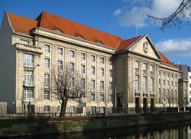
Deutsch:
Der Bendlerblock am Reichpietschufer 74/76 in Berlin-Tiergarten, erbaut 1911-1914 als Reichsmarineamt, heute Berliner Dienstsitz des Bundesverteidigungsministeriums. Im Vordergrund der Landwehrkanal.
English:
The Bendlerblock at Reichpietschufer No. 74/76 in Berlin-Tiergarten, built 1911 to 1914 as Reichsmarineamt (Reich Navy Office), now Berlin residence of the Bundesverteidigungsministerium (Federal Ministry of Defense). The Landwehrkanal can be seen in the foreground.
|
| Date | |
| Source | Own work |
| Author | Jörg Zägel |
| Camera location |
|
View this and other nearby images on: OpenStreetMap |
|
|---|
Licensing
I, the copyright holder of this work, hereby publish it under the following licenses:
This file is licensed under the
Creative Commons
Attribution-Share Alike 3.0 Unported
license.
-
You are free:
- to share – to copy, distribute and transmit the work
- to remix – to adapt the work
-
Under the following conditions:
- attribution – You must give appropriate credit, provide a link to the license, and indicate if changes were made. You may do so in any reasonable manner, but not in any way that suggests the licensor endorses you or your use.
- share alike – If you remix, transform, or build upon the material, you must distribute your contributions under the same or compatible license as the original.

|
Permission is granted to copy, distribute and/or modify this document under the terms of the GNU Free Documentation License , Version 1.2 or any later version published by the Free Software Foundation ; with no Invariant Sections, no Front-Cover Texts, and no Back-Cover Texts. A copy of the license is included in the section entitled GNU Free Documentation License . |
You may select the license of your choice.