Bartlesville_Sand_structure_map,_north.jpg

Size of this preview:
800 × 522 pixels
.
Other resolutions:
320 × 209 pixels
|
640 × 418 pixels
|
1,024 × 668 pixels
|
1,421 × 927 pixels
.
Summary
| Description |
English:
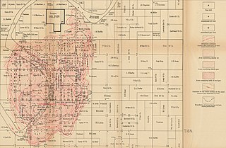
Bartlesville Sand structure map, north
|
| Date | |
| Source | Geologic structure in the Cushing oil and gas field, Oklahoma and its relation to the oil, gas, and water, USGS Bulletin 658, https://pubs.er.usgs.gov/publication/b658 |
| Author | Carl Hugh Beal |
Licensing
|
|
This image is in the
public domain
in the United States because it only contains materials that originally came from the
United States Geological Survey
, an agency of the
United States Department of the Interior
. For more information, see
the official USGS copyright policy
.
|
|