Bart_May_15_1996_2259Z.jpg
Size of this preview:
600 × 600 pixels
.
Other resolutions:
240 × 240 pixels
|
601 × 601 pixels
.
Summary
| Description |
English:
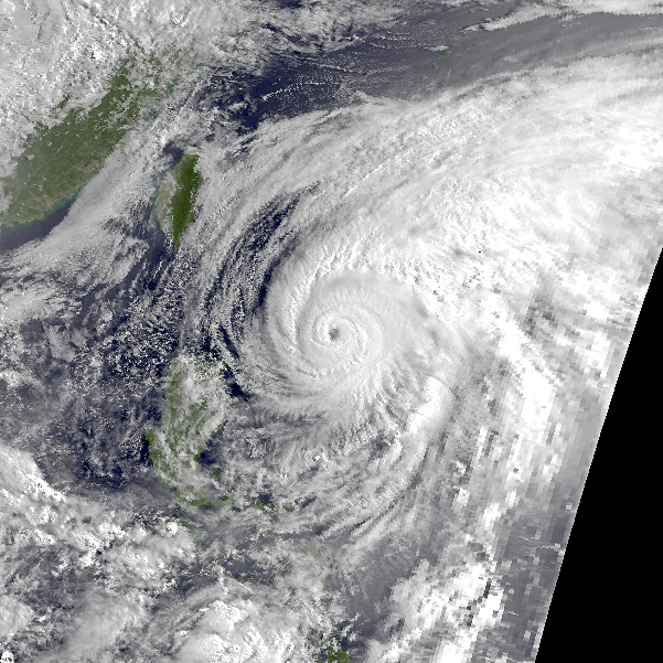
Typhoon Bart on May 15, 1996. At the time Bart had winds of 94.6 knts (108.9 mph, 175.4 kph), 1-min sustained and a pressure of 950 mbar. Bart was about 135 miles away from land. This image was taken by the NOAA-12 Satellite.
|
| Date | |
| Source | Satellite data = http://lwf.ncdc.noaa.gov/oa/ncdc.html Land and ocean data = http://earthobservatory.nasa.gov/Features/BlueMarble/BlueMarble_monthlies.php This image was created using these two sources. |
| Author | National Oceanic and Atmospheric Administration |
Licensing
|
|
This image is in the
public domain
because it contains materials that originally came from the U.S.
National Oceanic and Atmospheric Administration
, taken or made as part of an employee's official duties.
|
|