Australian_Capital_Territory_parishes.png
Size of this preview:
396 × 599 pixels
.
Other resolutions:
158 × 240 pixels
|
600 × 908 pixels
.
Summary
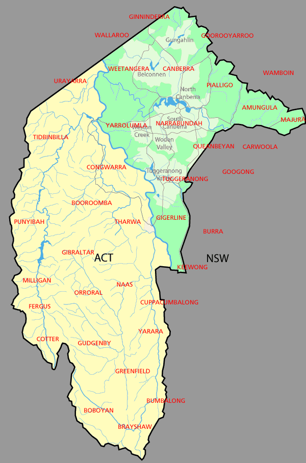
| Description | Parishes (shown in red) in the area of the Australian Capital Territory . The ones wholly within the ACT are former parishes and do not exist anymore. The land in green was part of Murray County , that in yellow part of Cowley County . (Divided by the Murrumbidgee River ) |
| Date | |
| Source | Made from Martyman 's GFDL map of the ACT here , using information from the National Library of Australia map here (Map showing proposed Federal Capital Territory and tenures of land within same, 1909) |
| Author | derivative of Martyman 's GFDL map |
Licensing

|
Permission is granted to copy, distribute and/or modify this document under the terms of the GNU Free Documentation License , Version 1.2 or any later version published by the Free Software Foundation ; with no Invariant Sections, no Front-Cover Texts, and no Back-Cover Texts. A copy of the license is included in the section entitled GNU Free Documentation License . |
|
|
This file is licensed under the Creative Commons Attribution-Share Alike 3.0 Unported license. | |
|
||
| This licensing tag was added to this file as part of the GFDL licensing update . |