Australia_Victoria_Colac_Otway_Shire_location_map.svg

Size of this PNG preview of this SVG file:
419 × 599 pixels
.
Other resolutions:
168 × 240 pixels
|
336 × 480 pixels
|
537 × 768 pixels
|
717 × 1,024 pixels
|
1,433 × 2,048 pixels
|
534 × 763 pixels
.
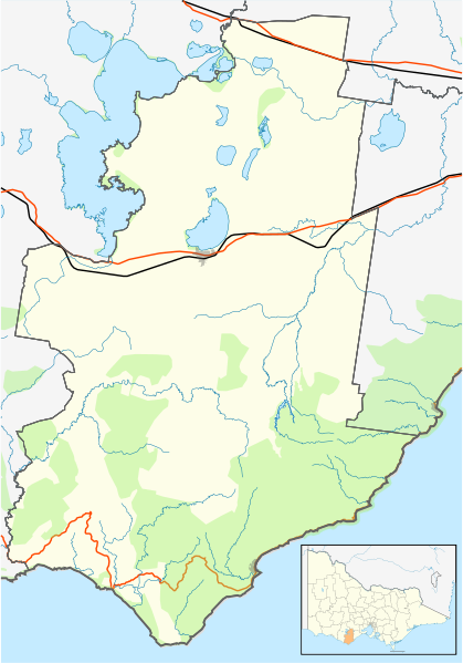
| Description |
English:
Blank map of
w:Colac Otway Shire
, Victoria, Australia, with the following information shown:
Geographic limits:
|
||
| Source | Own work | ||
| Author | Cassowary |
