Atoll_de_Wotho.png

Size of this preview:
395 × 599 pixels
.
Other resolutions:
158 × 240 pixels
|
456 × 691 pixels
.
Summary
| Description |
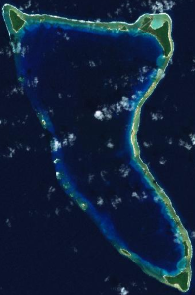
Français :
Atoll de Wotho aux îles Marshall.
|
| Date | Unknown date |
| Source | http://explorer.worldwind.earth/?layers=Blue%20Marble%20%26%20Landsat&lat=10.0848577&lon=165.9855418&alt=35276.41&heading=0&tilt=0&roll=0 |
| Author | NASA |
Licensing
|
|
This image is in the
public domain
because it is a screenshot from
NASA
’s globe software
World Wind
using a public domain layer, such as Blue Marble, MODIS, Landsat, SRTM, USGS or GLOBE.
|

|