Atlantic_Forest_WWF.jpg

Size of this preview:
595 × 599 pixels
.
Other resolutions:
238 × 240 pixels
|
477 × 480 pixels
|
763 × 768 pixels
|
1,017 × 1,024 pixels
|
2,034 × 2,048 pixels
|
2,877 × 2,897 pixels
.
Summary
| Description |
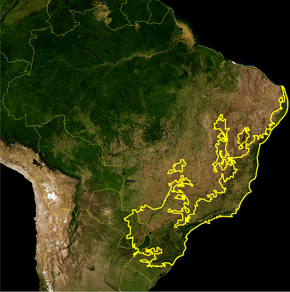
English:
Location map of the
Atlantic Forest biome
— in Brazil, Argentina, and Uruguay.
Português:
Este mapa mostra a localização da ecorregiao da Mata Atlântica. A linha amarelle delimita essa ecorregião como definida pelo
WWF
. Eu,Miguelrangeljr, fiz isso usando uma mapa de satélite da NASA e me baseei no livro Visão da Biodiversidade - Floresta Atlântica do Alto Paraná para desenhar a linha, usando o Corel Draw X4 e o Adobe Photoshop CS5.
|
|||||
| Date | ||||||
| Source | NASA plus my editions by myself | |||||
| Author | NASA and Miguelrangeljr | |||||
|
Permission
( Reusing this file ) |
|
Licensing
|
|
This file is in the public domain in the United States because it was solely created by NASA . NASA copyright policy states that "NASA material is not protected by copyright unless noted ". (See Template:PD-USGov , NASA copyright policy page or JPL Image Use Policy .) |
|

|
Warnings:
|