Argentinamap3.png

Size of this preview:
334 × 598 pixels
.
Other resolutions:
134 × 240 pixels
|
451 × 808 pixels
.
Summary
| Description |
English:
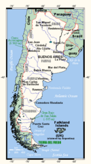
Map of Argentina showing main towns, highest and lowest points, and other relevant information.
|
| Date | 11 March 2005 (original upload date) |
| Source | This map was created at Online Map Creation |
| Author | Kelisi at English Wikipedia / Later version(s) were uploaded by Geni at English Wikipedia . |
Licensing
Kelisi
at the
English-language Wikipedia
, the copyright holder of this work, hereby publishes it under the following license:
|
|
This file is licensed under the Creative Commons Attribution-Share Alike 3.0 Unported license. Subject to disclaimers . | |
| Attribution: Kelisi at the English-language Wikipedia | ||
|
||
| This licensing tag was added to this file as part of the GFDL licensing update . |

|
Permission is granted to copy, distribute and/or modify this document under the terms of the GNU Free Documentation License , Version 1.2 or any later version published by the Free Software Foundation ; with no Invariant Sections, no Front-Cover Texts, and no Back-Cover Texts. A copy of the license is included in the section entitled GNU Free Documentation License . Subject to disclaimers . |
|
|
The map has been created with the
Generic Mapping Tools
:
https://www.generic-mapping-tools.org/
using one or more of these
public-domain
datasets for the relief:
|

|
Permission is granted to copy, distribute and/or modify this document under the terms of the GNU Free Documentation License , Version 1.2 or any later version published by the Free Software Foundation ; with no Invariant Sections, no Front-Cover Texts, and no Back-Cover Texts. A copy of the license is included in the section entitled GNU Free Documentation License . |
|
|
This file is licensed under the Creative Commons Attribution-Share Alike 3.0 Unported license. | |
|
||
| This licensing tag was added to this file as part of the GFDL licensing update . |
Original upload log
Transferred from en.wikipedia to Commons by Quadell using CommonsHelper .
The original description page was
here
. All following user names refer to en.wikipedia.
- 2005-04-02 02:15 Kelisi 451×808× (27754 bytes) New colours
- 2005-03-27 23:09 Geni 452×808× (27648 bytes) map with pastel colours
- 2005-03-11 22:54 Kelisi 452×808× (28532 bytes) Map of Argentina showing main towns, highest and lowest points, and other relevant information. This map was created at Online Map Creation, and may be considered PD.
Original upload log
| Date/Time | Dimensions | User | Comment |
|---|---|---|---|
| 24 June 2013, 16:49:30 | 451 × 808 (27754 bytes) | File Upload Bot (Magnus Manske) ( talk · contribs ) | Transfered from en.wikipedia by [[User:Quadell]] using CommonsHelper |