Archipel_des_Tuamotu.jpg

Size of this preview:
800 × 545 pixels
.
Other resolutions:
320 × 218 pixels
|
640 × 436 pixels
|
1,024 × 698 pixels
|
1,280 × 873 pixels
|
2,560 × 1,745 pixels
|
4,400 × 3,000 pixels
.
Summary
| Description |
English:
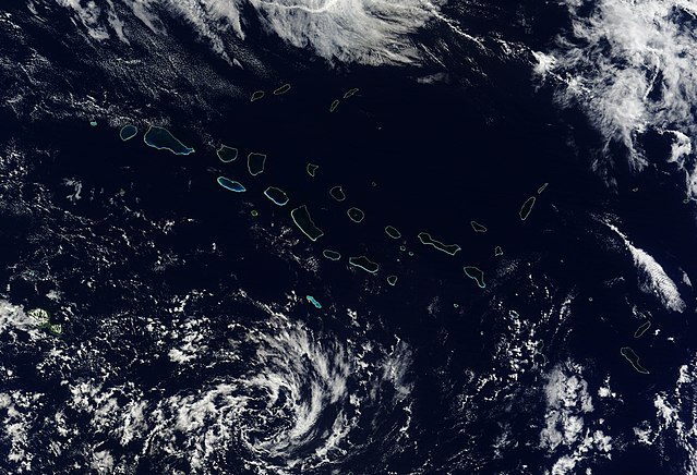
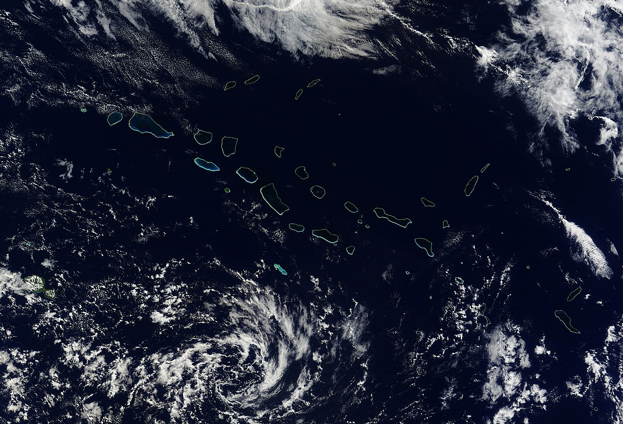
Natural-colour image of the north-western portion of the archipelago, including the largest coral atoll in the group,
Rangiroa
. Delicate rings of iridescent
blue
-
green
surround deep blue
waters
and
clouds
float overhead. At the north-western extent of the island chain—including islands shown in this image—rocks date to roughly 65 million years ago.
|
| Date | |
| Source | NASA Earth Observatory |
| Author | Jeff Schmaltz |
Image captured by the Moderate Resolution Imaging Spectroradiometer (MODIS) on NASA’s Terra satellite.
Licensing
|
|
This file is in the public domain in the United States because it was solely created by NASA . NASA copyright policy states that "NASA material is not protected by copyright unless noted ". (See Template:PD-USGov , NASA copyright policy page or JPL Image Use Policy .) |
|

|
Warnings:
|
| Annotations | This image is annotated: View the annotations at Commons |