Anthia_cinctipennis_(Lequien,_1832)_(3043601956).jpg

Size of this preview:
800 × 521 pixels
.
Other resolutions:
320 × 208 pixels
|
640 × 417 pixels
|
1,024 × 666 pixels
|
1,280 × 833 pixels
|
3,007 × 1,957 pixels
.
Summary
| Description |
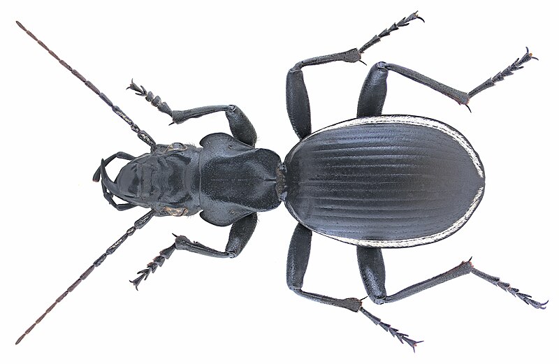
Familie: Carabidae Grösse: 37-42 mm Fundort: Namibia, Etosha National Parc leg. U.Schmidt, 1994; det. W.Lorenz Foto: U.Schmidt, 2007 |
| Date | |
| Source | Anthia cinctipennis (Lequien, 1832) |
| Author | Udo Schmidt from Deutschland |
| Camera location |
|
View this and other nearby images on: OpenStreetMap |
|
|---|
_(3043601956).jpg¶ms=-18.895892_N_0016.413574_E_globe:Earth_type:camera_source:Flickr_&language=en)
Licensing
This file is licensed under the
Creative Commons
Attribution-Share Alike 2.0 Generic
license.
-
You are free:
- to share – to copy, distribute and transmit the work
- to remix – to adapt the work
-
Under the following conditions:
- attribution – You must give appropriate credit, provide a link to the license, and indicate if changes were made. You may do so in any reasonable manner, but not in any way that suggests the licensor endorses you or your use.
- share alike – If you remix, transform, or build upon the material, you must distribute your contributions under the same or compatible license as the original.
|
|
This image was originally posted to Flickr by urjsa at https://www.flickr.com/photos/30703260@N08/3043601956 . It was reviewed on 15 February 2015 by FlickreviewR and was confirmed to be licensed under the terms of the cc-by-sa-2.0. |
| This file by Udo Schmidt was uploaded as part of the Share Your Knowledge project developed within WikiAfrica . |
|