Anoka_Cnty_Minnesota_Incorporated_and_Unincorporated_areas_Centerville_Highlighted_copy.png
No higher resolution available.
Summary

|
This file was moved to Wikimedia Commons from en.wikipedia using a bot script. All source information is still present. It requires review . Additionally, there may be errors in any or all of the information fields; information on this file should not be considered reliable and the file should not be used until it has been reviewed and any needed corrections have been made. Once the review has been completed, this template should be removed. For details about this file, see below. Check now! |
| Description |
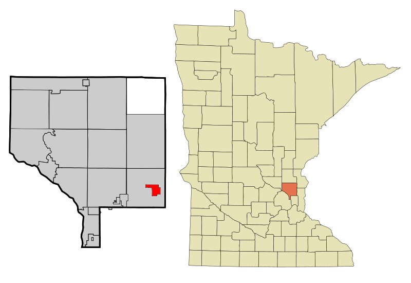
English:
This map shows the incorporated and unincorporated areas in
Anoka County
, highlighting Centerville in red. This file has been updated to reflect the recent incorporation of new municipalities.
|
| Date | |
| Source | Based on older versions by Arkyan . |
| Author | 123dieinafire |
Licensing
|
|
This work has been released into the
public domain
by its author,
123dieinafire
at
English Wikipedia
. This applies worldwide.
In some countries this may not be legally possible; if so: 123dieinafire grants anyone the right to use this work for any purpose , without any conditions, unless such conditions are required by law. |
Original upload log
Transferred from en.wikipedia to Commons by Dharmadhyaksha using CommonsHelper .
The original description page was
here
. All following user names refer to en.wikipedia.
- 2009-09-25 09:56 123dieinafire 800×550× (75774 bytes) {{Information |Description = This map shows the incorporated and unincorporated areas in [[Anoka County, Minnesota]], highlighting Centerville in red. This file has been updated to reflect the recent incorporation of new mu