AlbanyCounty_Map_2.svg

Size of this PNG preview of this SVG file:
766 × 594 pixels
.
Other resolutions:
310 × 240 pixels
|
619 × 480 pixels
|
991 × 768 pixels
|
1,280 × 993 pixels
|
2,560 × 1,985 pixels
.
Summary
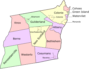
| Description |
English:
Map of
Albany County
,
New York
,
United States
showing its constituent
cities
,
towns
, and
villages
|
| Date | |
| Source | Own work |
| Author | UpstateNYer and ZooFari |
This
Scalable Vector Graphic
was made or vectorized by
ZooFari
using
Inkscape
(see all
SVGs
and
images
).
Licensing
This file is licensed under the
Creative Commons
Attribution 3.0 Unported
license.
-
You are free:
- to share – to copy, distribute and transmit the work
- to remix – to adapt the work
-
Under the following conditions:
- attribution – You must give appropriate credit, provide a link to the license, and indicate if changes were made. You may do so in any reasonable manner, but not in any way that suggests the licensor endorses you or your use.