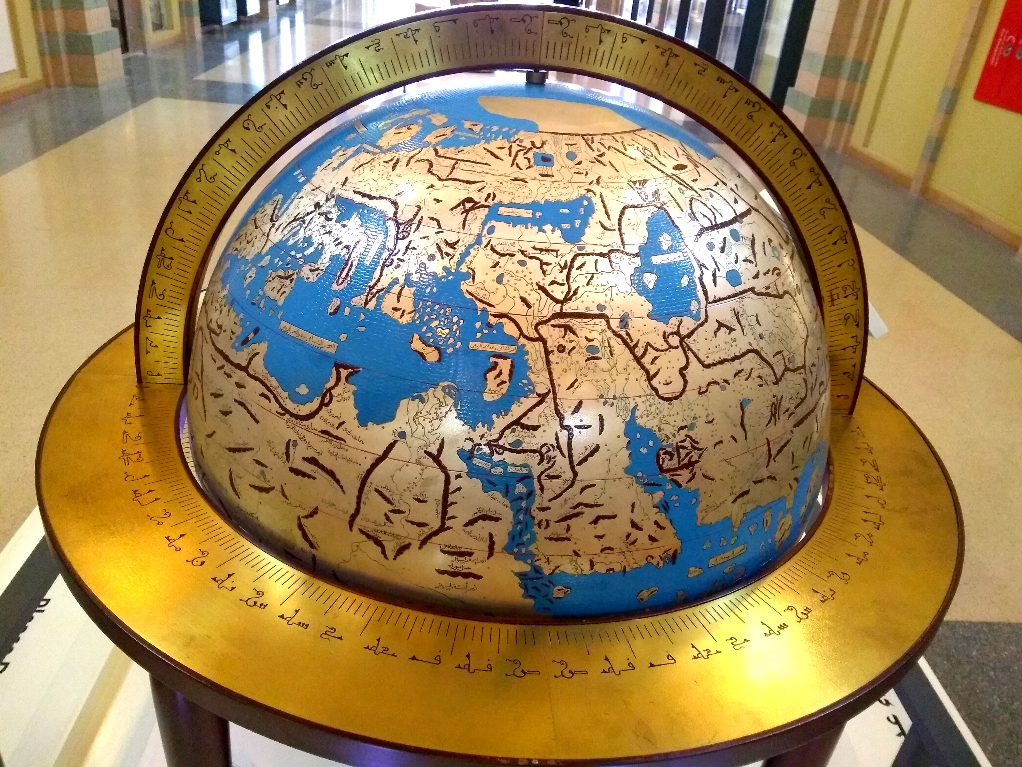
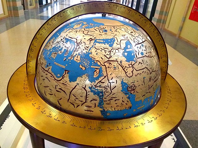
Al'Idrisi's_World_Map.jpg
Size of this preview:
800 × 600 pixels
.
Other resolutions:
320 × 240 pixels
|
640 × 480 pixels
|
1,024 × 768 pixels
|
1,280 × 960 pixels
|
2,560 × 1,920 pixels
|
4,160 × 3,120 pixels
.
Summary
| Description |
Sicilianu:
Mappa dû munnu di Muhammad al-Idrisi (1154). Riproduzzioni dû planisferiu ntagghiatu su na lastra d'argentu pi lu Re Ruggeru II di Sicilia. In mostra ô Museu dâ Civiltà Islamica di Sharjah (EAU).
Polski:
Mapa świata Muhammada al-Idrisiego (1154). Reprodukcja planisfery wygrawerowanej na srebrnej płycie dla króla Sycylii Rogera II. Na wystawie w Muzeum Cywilizacji Islamskiej w Szardży (ZEA).
English:
World map by Muhammad al-Idrisi (1154). Reproduction of the planisphere engraved on a silver plate for King Roger II of Sicily. On display at the Sharjah Museum of Islamic Civilization (UAE).
Italiano:
Mappa del mondo di Muhammad al-Idrisi (1154). Riproduzione del planisferio inciso su una lastra d'argento per il re Roger II di Sicilia. In mostra al Museo della Civiltà Islamica di Sharjah (EAU).
|
| Date | |
| Source | Own work |
| Author | S N Barid |
| Camera location |
|
View this and other nearby images on: OpenStreetMap |
|
|---|
Licensing
I, the copyright holder of this work, hereby publish it under the following license:
This file is licensed under the
Creative Commons
Attribution-Share Alike 4.0 International
license.
-
You are free:
- to share – to copy, distribute and transmit the work
- to remix – to adapt the work
-
Under the following conditions:
- attribution – You must give appropriate credit, provide a link to the license, and indicate if changes were made. You may do so in any reasonable manner, but not in any way that suggests the licensor endorses you or your use.
- share alike – If you remix, transform, or build upon the material, you must distribute your contributions under the same or compatible license as the original.