Afghanistan_insurgency_1985.jpg
Size of this preview:
767 × 599 pixels
.
Other resolutions:
307 × 240 pixels
|
614 × 480 pixels
|
983 × 768 pixels
|
1,280 × 1,000 pixels
|
2,401 × 1,876 pixels
.

|
This file has been
superseded
by
Afghanistan insurgency 1985.png
. It is recommended to use the other file. Please note that deleting superseded images
requires consent
.
Reason to use the other file:
"A PNG version of this file is now available."
|

|
Summary
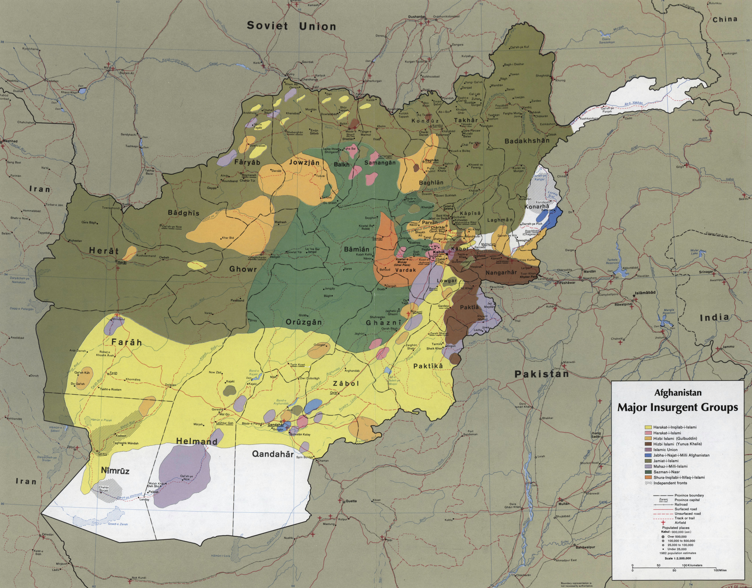
| Description | CIA map showing the areas where the main Mujahideen factions operated in 1985, during the Soviet war in Afghanistan. Scale 1:2,500,000 (E 600--E 750/N 380--N 290). | ||
| Date | |||
| Source |
|
||
| Author | Central Intelligence Agency | ||
|
Permission
( Reusing this file ) |
US Federal publication, in public domain. |

Licensing
|
|
This image is a work of a
Central Intelligence Agency
employee, taken or made as part of that person's official duties. As a Work of the United States Government, this image or media is in the
public domain
in the United States.
|

|