2018-09-28_Palu,_Indonesia_M7.5_earthquake_shakemap_new_version.jpg

Size of this preview:
448 × 599 pixels
.
Other resolutions:
179 × 240 pixels
|
359 × 480 pixels
|
749 × 1,001 pixels
.
Summary
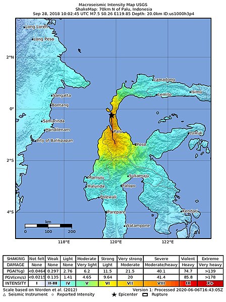
| Description | USGS ShakeMap of the 2018 Sulawesi earthquake |
| Source | https://earthquake.usgs.gov/earthquakes/eventpage/us1000h3p4/shakemap/intensity |
| Author | United States Geological Survey |
Licensing
|
|
This image is in the
public domain
in the United States because it only contains materials that originally came from the
United States Geological Survey
, an agency of the
United States Department of the Interior
. For more information, see
the official USGS copyright policy
.
|
|