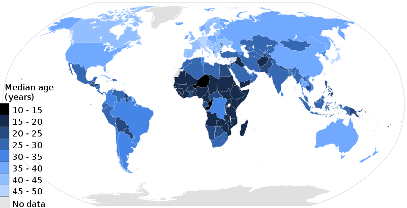
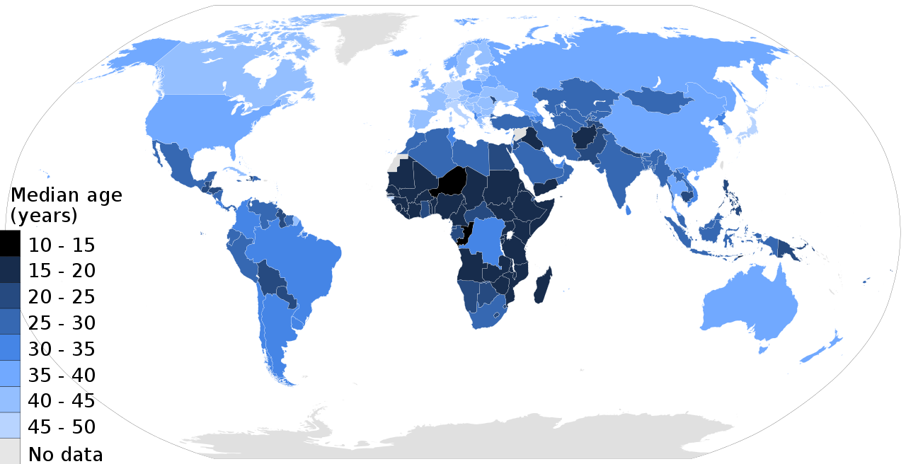
2017_world_map,_median_age_by_country.svg

Size of this PNG preview of this SVG file:
800 × 410 pixels
.
Other resolutions:
320 × 164 pixels
|
640 × 328 pixels
|
1,024 × 525 pixels
|
1,280 × 656 pixels
|
2,560 × 1,313 pixels
|
864 × 443 pixels
.
W3C-validity not checked.
Summary
| Description |
English
:
A country's median age in years is the age that divides the country's population in two parts of equal size, that is, there are as many persons with ages above the median as there are with ages below the median. It is indicator of relative aging of the population, birth rates, early death rates and weighted age groups.
العربية
:
خريطة تُظهر مُتوسِّط الأعمار في العالم سنة 2017م
|
| Date | |
| Source | Own work , data from United Nations ESA (2017) |
| Author | Ms Sarah Welch |
| Other versions |
This file was derived from:
BlankMap-World6.svg
Derivative works of this file: 2017 world map, median age by country-ar.svg |
Licensing
I, the copyright holder of this work, hereby publish it under the following license:
This file is licensed under the
Creative Commons
Attribution-Share Alike 4.0 International
license.
-
You are free:
- to share – to copy, distribute and transmit the work
- to remix – to adapt the work
-
Under the following conditions:
- attribution – You must give appropriate credit, provide a link to the license, and indicate if changes were made. You may do so in any reasonable manner, but not in any way that suggests the licensor endorses you or your use.
- share alike – If you remix, transform, or build upon the material, you must distribute your contributions under the same or compatible license as the original.