1900_NYCRR.jpg

Size of this preview:
800 × 475 pixels
.
Other resolutions:
320 × 190 pixels
|
640 × 380 pixels
|
1,024 × 608 pixels
|
1,280 × 760 pixels
|
2,560 × 1,519 pixels
|
10,788 × 6,402 pixels
.
| Warning | The original file is very high-resolution. It might not load properly or could cause your browser to freeze when opened at full size. |
|---|
Summary
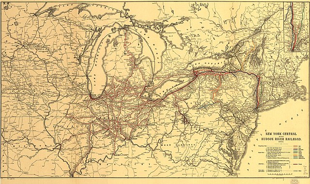
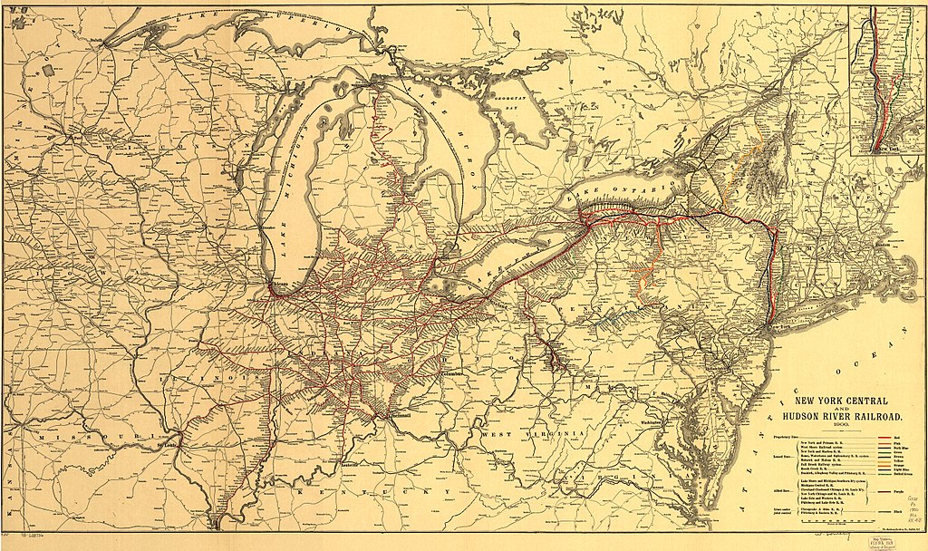
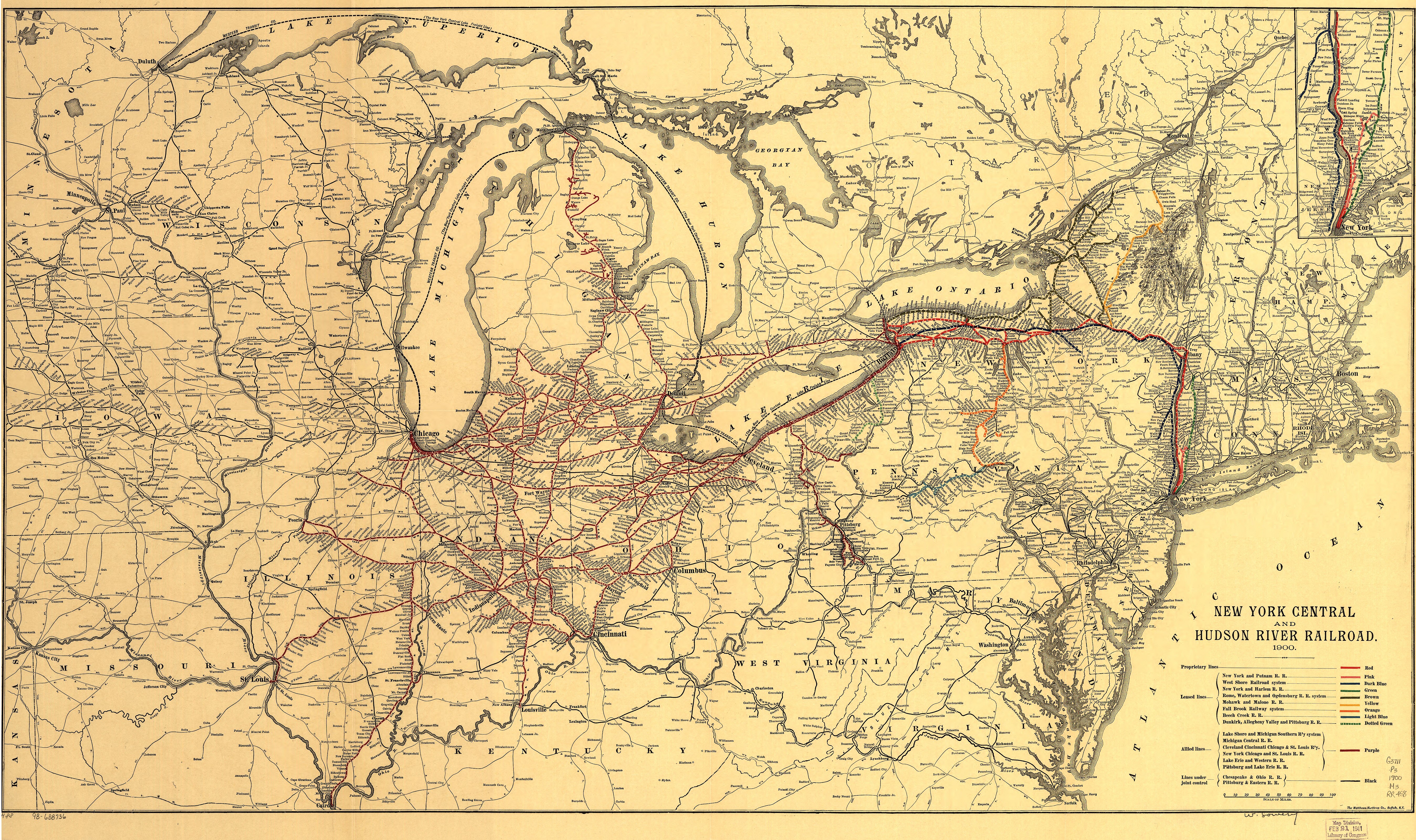
1900 map of the New York Central and Hudson River Railroad, from Library of Congress .

|
This map is available from the United States
Library of Congress
's
Geography & Map Division
under the digital ID g3711p.rr004880 . This tag does not indicate the copyright status of the attached work. A normal copyright tag is still required. See Commons:Licensing .
|
Licensing
|
|
This media file is in the
public domain
in the
United States
. This applies to U.S. works where the copyright has expired, often because its first
publication
occurred prior to January 1, 1929, and if not then due to lack of notice or renewal. See
this page
for further explanation.
|

|

|
This image might not be in the public domain outside of the United States; this especially applies in the countries and areas that do not apply the
rule of the shorter term
for US works, such as Canada, Mainland China (not Hong Kong or Macao), Germany, Mexico, and Switzerland. The creator and year of publication are essential information and must be provided. See
Wikipedia:Public domain
and
Wikipedia:Copyrights
for more details.
|