1876_1st_Essex_senate_district_map_Massachusetts.jpg

Size of this preview:
800 × 487 pixels
.
Other resolutions:
320 × 195 pixels
|
640 × 390 pixels
|
1,024 × 624 pixels
|
1,280 × 780 pixels
|
3,200 × 1,949 pixels
.
Summary
| Description |
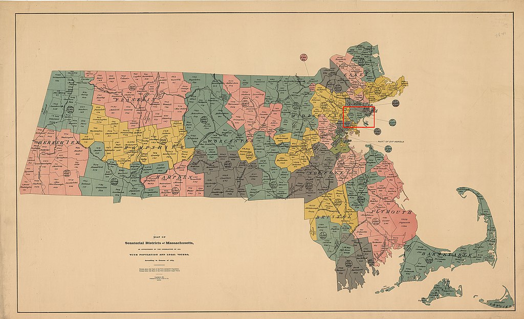
Map of districts of the Massachusetts state senate apportioned in 1876. The map includes 1885 population information. The location of the 1st Essex senate district is highlighted in red. Acts and Resolves of the Massachusetts General Court, 1876 Chap. 0190 . An Act To Divide The Commonwealth Into Forty Districts For The Choice Of Senators: "...The city of Lynn and the towns of Nahant, Saugus and Swampscott, shall constitute a district, to be known as the First Essex District...." |
| Date | |
| Source | https://malegislature.gov/Redistricting/HistoricDistricts/Senate |
| Author | Rand, Avery & Co. |
|
|
This work is in the
public domain
in the
United States
because it was
published
(or registered with the
U.S. Copyright Office
) before January 1, 1929.
Public domain works must be out of copyright in both the United States and in the source country of the work in order to be hosted on the Commons. If the work is not a U.S. work, the file
must
have an additional
copyright tag
indicating the copyright status in the source country.
Note: This tag should not be used for sound recordings. |