1756_Bellin_Map_of_Kollam_Fort,_Kerala,_India_-_Geographicus_-_Coylan-bellin-1756.jpg

Size of this preview:
800 × 562 pixels
.
Other resolutions:
320 × 225 pixels
|
640 × 450 pixels
|
1,024 × 720 pixels
|
1,280 × 900 pixels
|
2,560 × 1,800 pixels
|
3,000 × 2,109 pixels
.
|
Jacques-Nicolas Bellin
: Plan de la Forteresse de Coylan.
(
|
||||||||||||||||||||
|---|---|---|---|---|---|---|---|---|---|---|---|---|---|---|---|---|---|---|---|---|
| Artist |
|
|||||||||||||||||||
| Title |
Plan de la Forteresse de Coylan.
|
|||||||||||||||||||
| Description |
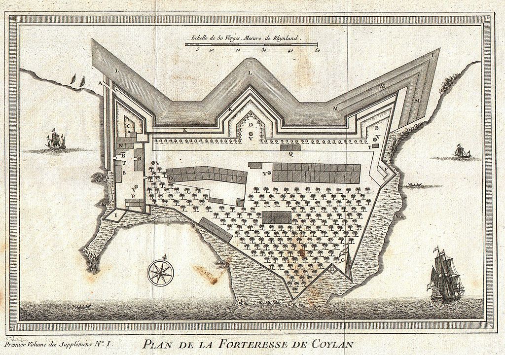
English:
This is a rare 1756 map of the fort of Kollam, Kerala, on India’s Malabar Coast by French cartographer N. Bellin. Kollam, or as it is otherwise Known Quilon or Coylan, lies roughly 71 km north of Trivandrum, India. Kollam Fort was originally built by the Portuguese, however, it was captured by the Dutch in 1671 and by the British in 1795. This map presents beautiful image of the fort completely with palm forests and sailing ships navigating the surrounding seals. Prepared by N. Bellin for issue in the 1757 edition of A. Provost’s L`Histoire Generale des Voyages .
|
|||||||||||||||||||
| Date | 1756 (undated) | |||||||||||||||||||
| Dimensions | height: 7.5 in (19 cm); width: 11 in (27.9 cm) | |||||||||||||||||||
| Accession number |
Geographicus link:
Coylan-bellin-1756
|
|||||||||||||||||||
| Source/Photographer |
Provost, A., L`Histoire Generale des Voyages , 1756.
|
|||||||||||||||||||
|
Permission
( Reusing this file ) |
|
|||||||||||||||||||