Bacolod_South_Road
The Bacolod South Road, also known as Negros South Road, is a 212.59-kilometer (132.10 mi), two-to-six lane major north–south lateral highway that connects the city of Bacolod[1] to the municipality of Hinoba-an[2] in the province of Negros Occidental,[3][4] Philippines.
| Bacolod South Road | ||||
|---|---|---|---|---|
| Negros South Road | ||||
Bacolod South Road as Araneta Avenue near the old Bacolod City Domestic Airport in Bacolod | ||||
| Route information | ||||
| Maintained by Department of Public Works and Highways (DPWH) | ||||
| Length | 212.59 km (132.10 mi) | |||
| Component highways | ||||
| Major junctions | ||||
| North end | ||||
| Major intersections |
| |||
| South end | ||||
| Location | ||||
| Country | Philippines | |||
| Provinces | Negros Occidental | |||
| Major cities | Bacolod, Bago, Himamaylan, Kabankalan, Sipalay | |||
| Towns | Valladolid, San Enrique, Pontevedra, Hinigaran, Binalbagan, Ilog, Cauayan, Hinoba-an | |||
| Highway system | ||||
| ||||
| ||||
.svg)
.svg)
.svg)
.jpg)
The road forms part of National Route 7 (N7), National Route 6 (N6), and National Route 712 (N712) of the Philippine highway network and of the Western Nautical Highway of the Philippine Nautical Highway System.
True to its name, the road connects Bacolod downtown to the southern municipalities and cities of Negros Occidental up to Hinoba-an, where the province also shares its boundary with Negros Oriental.[5] Its segment from Bacolod to Kabankalan also forms part of the Western Nautical Highway of the Philippine Nautical Highway System.
Bacolod
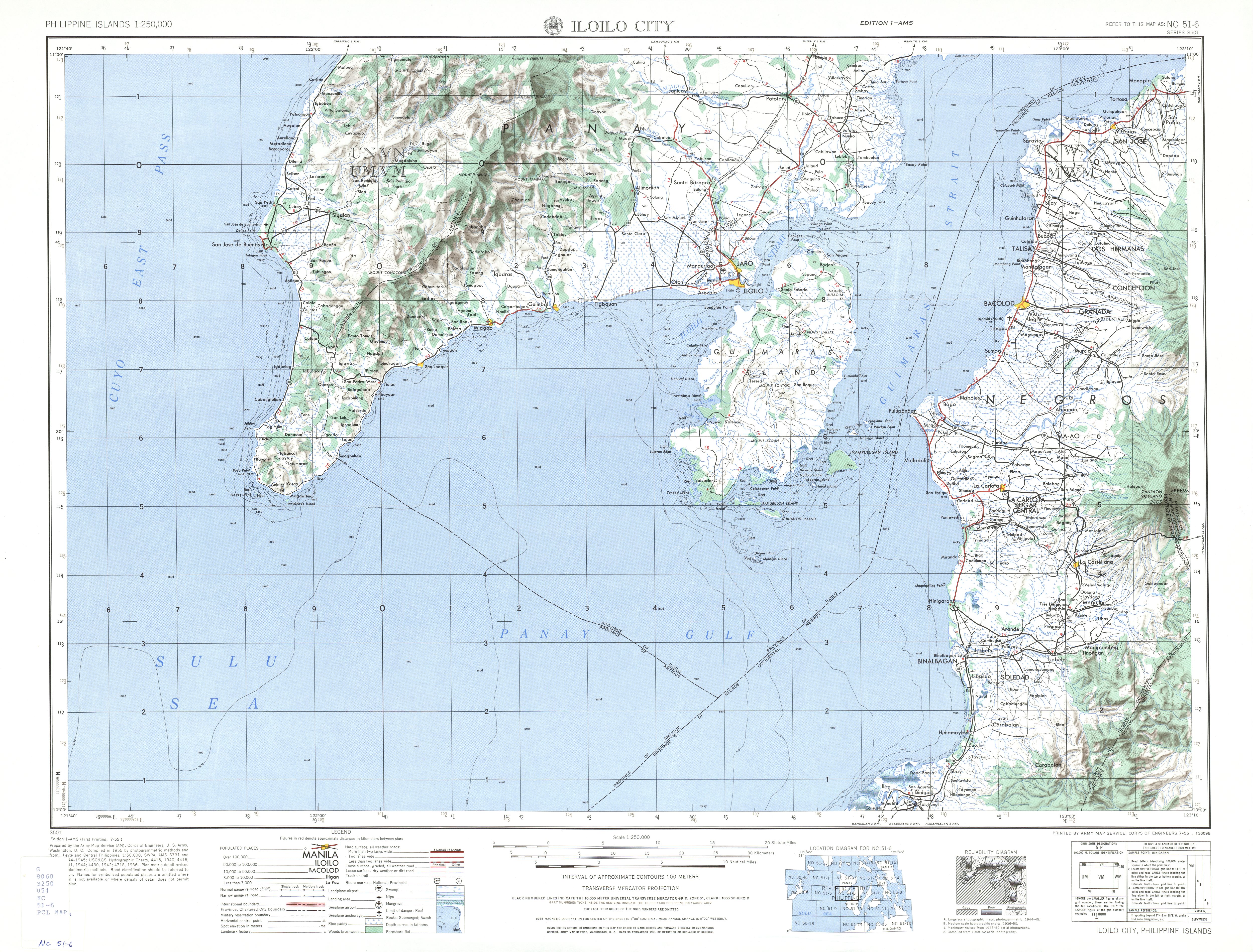
The road starts at the kilometer zero of Negros Occidental in front of the Negros Occidental Provincial Capitol in Bacolod. There, the road assumes the local name Lacson Street and is part of N7 as it continues the Bacolod North Road. It then turns near the Bacolod City Plaza as Jose Rizal Street, Gatuslao Street, Gonzaga Street, and Araneta Avenue (beginning from its intersection with Sto. Niño–Banago Road, where Gonzaga Street continues), respectively. At the junction with Alijis Road, its route number changes from N7 to N6.
Bago to Kabankalan
In Bago, the road then turns away from the city proper and becomes also known as Bacolod South By-Pass Road, its newer right-of-way locally as R.M. Salas Drive. It then regains the Bacolod South Road name at Ubay Crossing past the Bago River. It continues its course along the western coast of Negros Occidental as it traverses Pulupandan, Valladolid, San Enrique, Pontevedra, Hinigaran, Binalbagan, Himamaylan, and Kabankalan, wherein from barangay Binicuil it is locally known as Guanzon Street. In the town propers of Pontevedra and Hinigaran, it is locally known in the town proper as Rizal Street.
Kabankalan to Hinoba-an
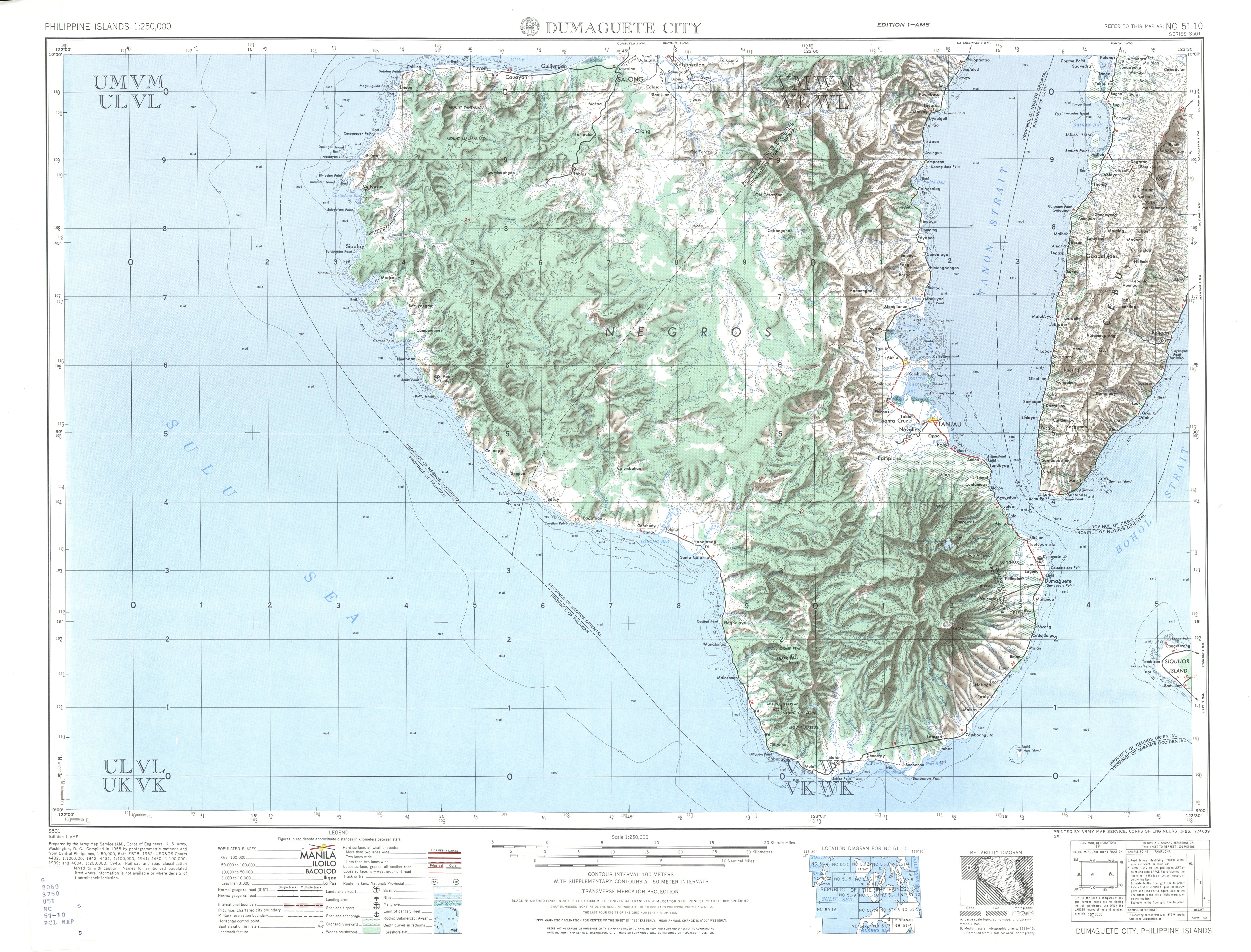
At its intersection with Bais–Kabankalan Road (Aquiles-Zayco Avenue) in Kabankalan city proper, the road's route number changes from N6 to N712, transitioning from a primary national road to a secondary national road, respectively. Shortly, it turns to the northeast locally known as Justice Y. Perez Avenue and continues its course along the western and southern coast of Negros Occidental. It terminates in Hinoba-an, near the provincial boundary with Negros Oriental, where it is continued by Dumaguete South Road.
The road was historically part of Highway 1 that incompletely inscribed the Negros Island. After the World War II, the road was extended from its former southern terminius in Sojoton Point in Cauayan to Hinoba-an.[6][7] Its right-of-way in Bago was also realigned through a new bypass road, away from the poblacion where it formerly traversed.[5][8]
.jpg)
Intersections are numbered by kilometer post, with Negros Occidental Provincial Capitol in Bacolod designated as kilometer zero.
| Province | City/Municipality | km | mi | Destinations | Notes |
|---|---|---|---|---|---|
| Bacolod | 0.000 | 0.000 | Northern terminus | ||
| Route number change from N7 to N6. | |||||
| 4.085 | 2.538 | Route number change from N7 to N6. | |||
| Negros Occidental | San Enrique | ||||
| Hinigaran | |||||
| Kabankalan | Route change from N6 to N712. | ||||
| Ilog | |||||
| Hinoba-an | Southern terminus | ||||
1.000 mi = 1.609 km; 1.000 km = 0.621 mi
| |||||
- "Bacolod City". www.dpwh.gov.ph. Retrieved January 5, 2019.[permanent dead link]
- "Negros Occidental 2nd". www.dpwh.gov.ph. Archived from the original on January 11, 2019. Retrieved January 5, 2019.
- "Negros Occidental 3rd". www.dpwh.gov.ph. Archived from the original on January 11, 2019. Retrieved January 5, 2019.
- "Negros Occidental 4th". www.dpwh.gov.ph. Archived from the original on January 11, 2019. Retrieved January 5, 2019.
- "Road and Bridge Inventory". Department of Public Works and Highways. Retrieved May 31, 2023.
- 1944 Army Map Service Road Map of the Central and Southern Philippines (Map). 1:1000000. Washington D.C.: Army Maps Service, Corps of Engineers. 1944. Retrieved May 31, 2023.
- NC 51-10 Dumaguete City (Map). 1:250,000. S501. Washington D.C.: Army Map Service, Corps of Engineers. 1954. Retrieved May 31, 2023.
- NC 51-6 Iloilo City (Map). 1:250,000. S501. Washington D.C.: Army Map Service, Corps of Engineers. 1954. Retrieved May 31, 2023.