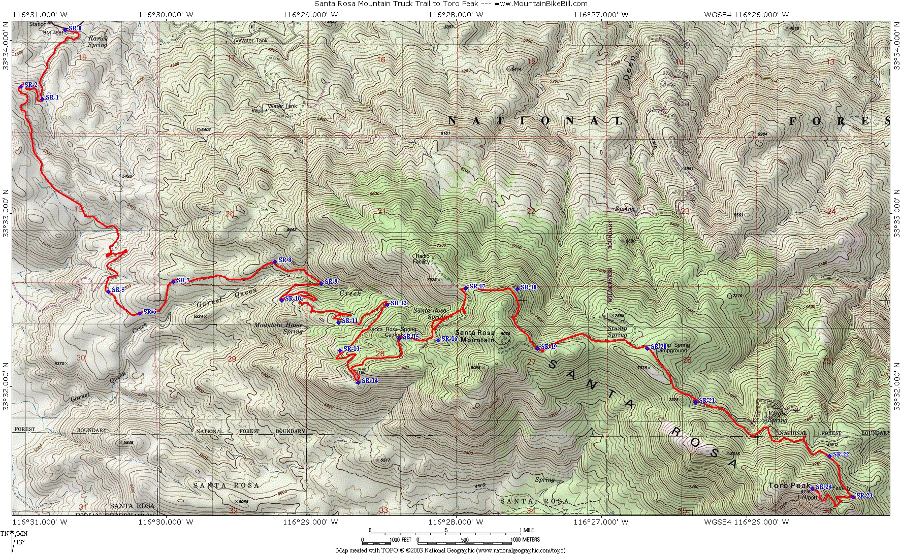
The mountain is accessible from California State Route 74 (also known as the Pines to Palms Highway) via a dirt road approximately 5 miles east of Route 74's junction with Route 371.
The dirt road begins at an elevation of 4,700 feet and heads towards the summit for approximately 13 miles. A 4x4 or off-road vehicle is recommended because the road is steep and rocky. It comes to a locked gate around 8,200ft and from there it is a 500-foot hike to the summit up a rough maintenance road that passes the former MCI (now owned by Verizon Communications) primary power generator that provides electricity to the summit.
Mixed Conifers, White Firs, Incense Cedars and Jeffrey Pines
Toro Peak and the Santa Rosa Mountains come under the category of sky island mountains. Vegetation on the mountain is a mixed variety of trees: Incense Cedar, White Fir, Jeffrey Pine, Ponderosa Pine, Sugar Pine and on the highest slopes Limber Pine, which is an ice age remnant species. Typical of mountains closest to the Pacific in California, these trees ignore the elevation separations of vegetation (known as life zones) that are found on many other mountains. For example, in the adjacent picture, trees such as White Fir and Incense Cedar, are seen growing on the lowest extent of the mountain beside dryer, weather-tolerant trees such as Jeffrey Pine and Ponderosa Pine.
Climate
In winter, the weather on Toro Peak and the Santa Rosa Mountains can be difficult. Snow falls on the mountain more than a few times during the winter and accounts for most of the annual precipitation, with a second percentage coming from monsoonal thunderstorms during the summer. Nighttime and daytime seasonal lows in the winter and seasonal summer highs are taken from the Long Valley Ranger Station on neighboring Mount San Jacinto.
Toro Peak 1939 Geological Survey Marker
This mountain is one of the many scattered sky islands in the southwest. Toro Peak's high elevation helps clear the smog emitted from Los Angeles and the Inland Empire. There is limited human activity beyond a few remote campsites on various parts of the mountain. The peak has a warm-summer Mediterranean climate (Csb).
More information Climate data for Toro Peak 1981-2010 (33.523 -116.426), Month ...
Climate data for Toro Peak 1981-2010 (33.523 -116.426)
This article uses material from the Wikipedia article Toro_Peak, and is written by contributors.
Text is available under a CC BY-SA 4.0 International License; additional terms may apply. Images, videos and audio are available under their respective licenses.