Sunset_Heights,_Houston
Sunset Heights is a neighborhood in northern Houston.
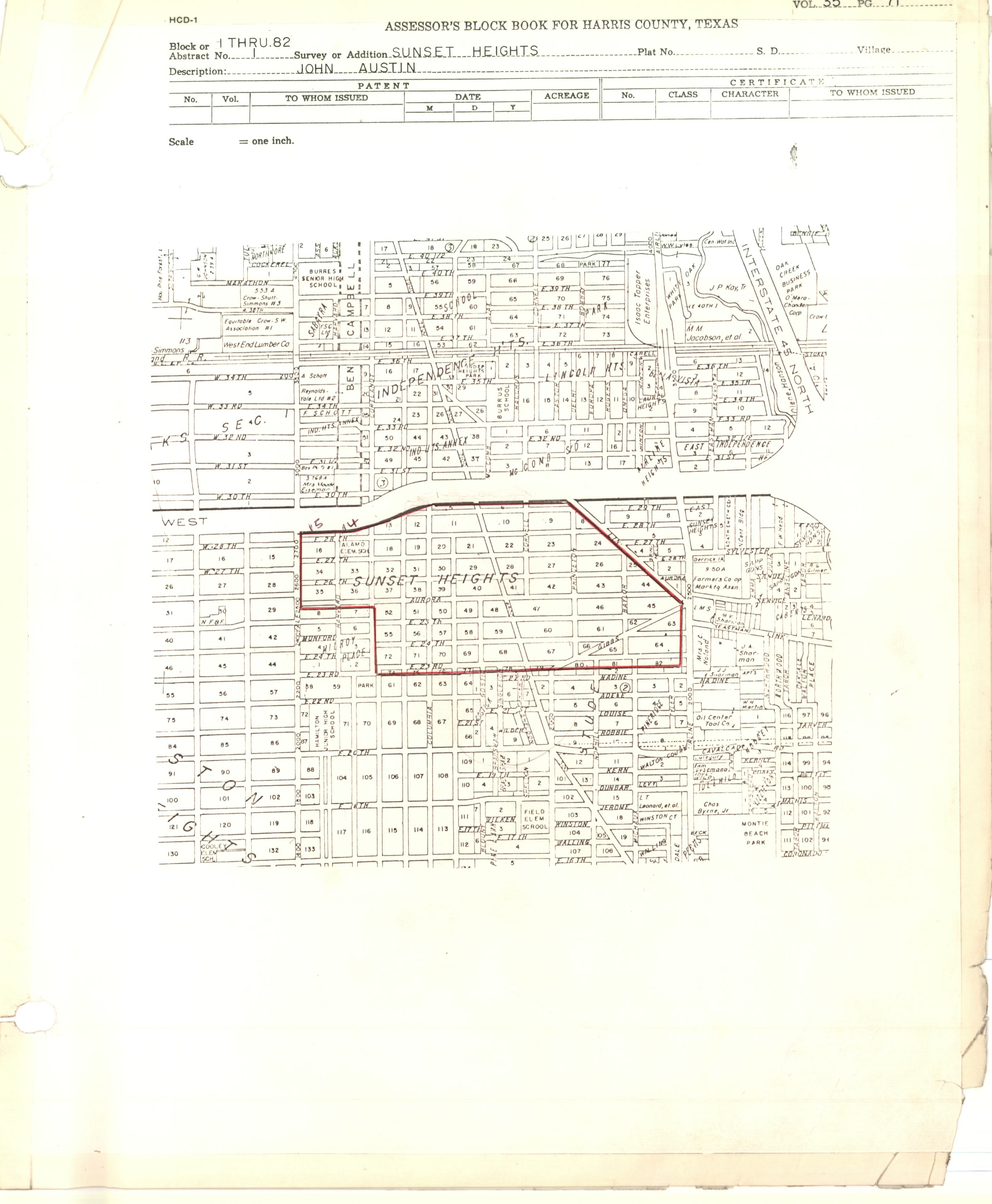
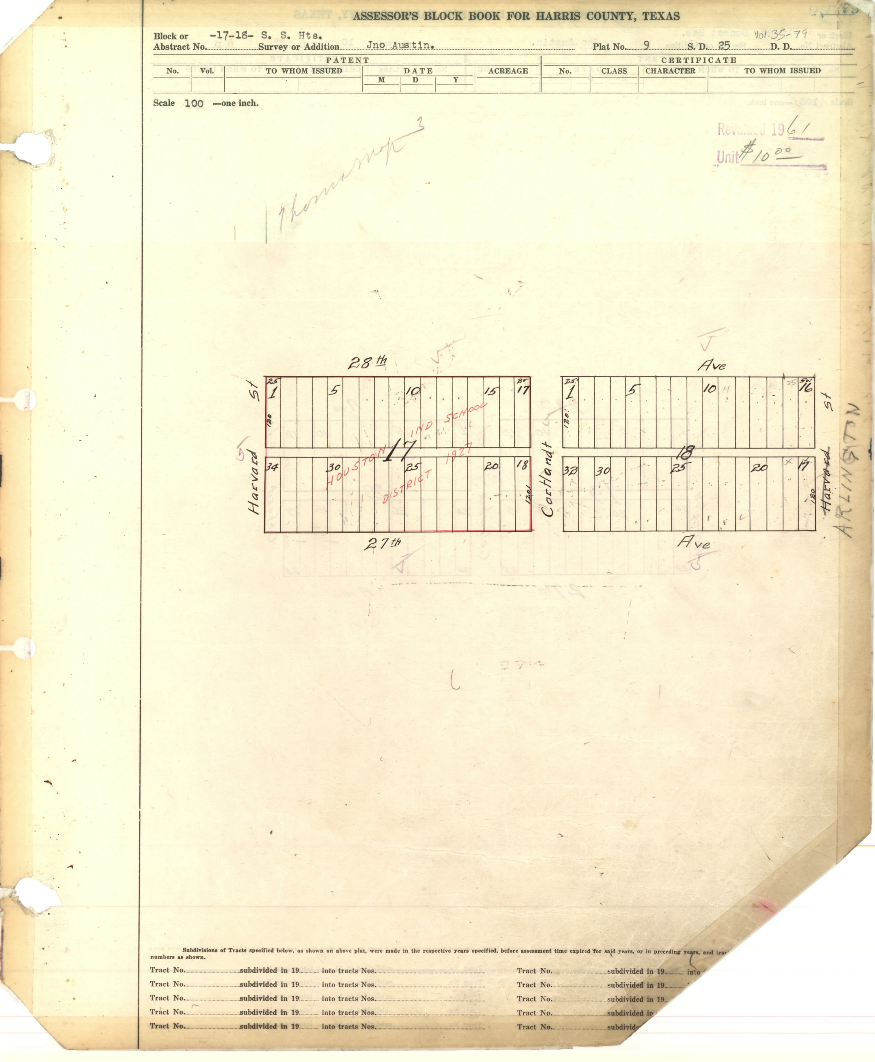
Sunset Heights Realty Co., established by Richard Rodgers, developed Sunset Heights after the company was created on August 15, 1910. The Houston Heights, when it was an independent municipality, unsuccessfully attempted to annex Sunset Heights. The City of Houston annexed Sunset Heights in 1927.[1]
By 2001 gentrification occurred in the area, with some smaller houses being torn down in favor of newer ones.[2]
East Sunset Heights Association was established in March 2002. By October of that year, there were 97 members.[3]
In 2006 Sunset Heights homeowners signed a petition to the city government to establish a minimum lot size.[4] Minimum lot sizes are pursued when area residents wish to oppose existing lots being divided into smaller ones for townhouses.[5] Later that year the Houston City Planning commission approved the development of a condominium project that went against the wishes of the people who signed the petition even though it strictly speaking complied with the city code planning regulations.[4] The planning commission also chose not to submit a request for deliberating the minimum lot size to Houston City Council, as seven planning commission members voted against it; six voted to do so. Tom Manning of the Houston Chronicle stated that residents disagreed on the issue.[6] On August 8, 2007, Houston City Council did establish a minimum lot size for this area.[7] In the Planning Commission barred a property owner from going below East Sunset Heights' minimum property size.[8]
Many of the houses in the neighborhood are bungalows.[4]
East Sunset Heights; roughly between Airline Drive, 23rd Street, the 610 Loop, and North Main; has about 400 houses.[3]
Harris Health maintains the Sunset Heights Clinic, a "same-day clinic".[9]
The neighborhood is within the Houston Independent School District (HISD).[10] Elementary schools serving sections of Sunset Heights include Field and Helms.[11][12] All residents are zoned to Hamilton Middle School and Heights High School in the Houston Heights.[13][14]
The first school established in the community was the Sunset Heights School, a part of Harris County School District 25. It was built in 1912 after taxpayers voted in favor for a referendum to build the school; the taxpayers had raised $20,000 for this purpose beginning the previous year. In 1926 the school was put in a new building and was now known as Alamo Elementary School;[1] it was in Sunset Heights block 76.[10][15] Its namesake was the Alamo. The school closed in 1980.[16] HISD began storing items in it and later listed it for sale. Preservation Houston stated that it was an endangered historic site.[1]
The City of Houston acquired the former Heights Transit Center, a METRO facility, in 2018.[17] In 2020 the city government announced the site would become the East Sunset Heights Park.[18] It is now Sunset Heights Park.[19]
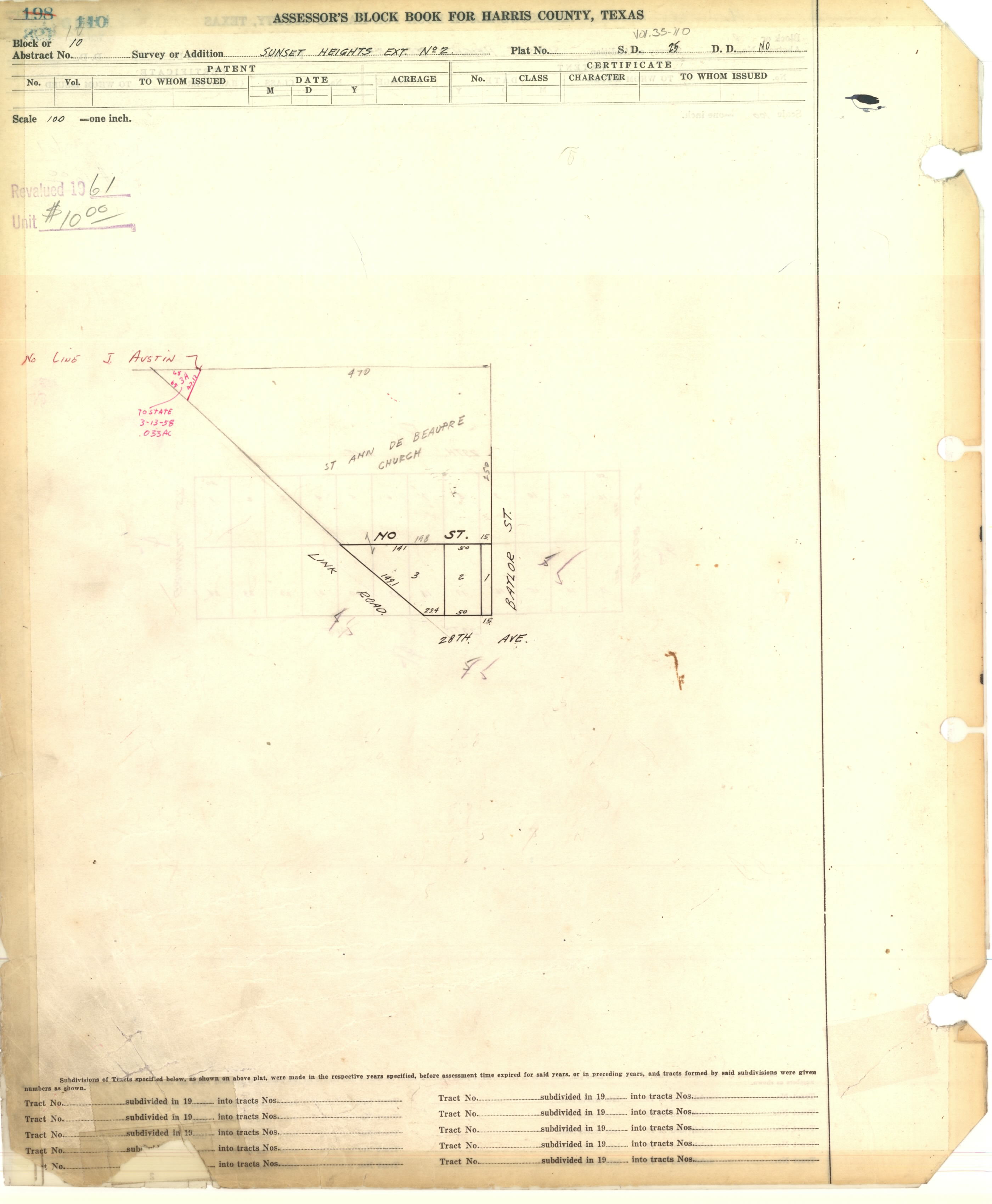
The Roman Catholic Archdiocese of Galveston-Houston operates St. Anne De Beaupre Church in Sunset Heights Extension No. 2.[20][21] The third black church in the city, named after the Basilica of Sainte-Anne-de-Beaupré in Sainte-Anne-de-Beaupré, Quebec, Canada, it opened in 1938. It was initially a dependency of Our Mother of Mercy Catholic Church. The naming after a Francophone Canadian site reflects the Louisiana Creole culture.[22]
- "Sunset Heights History". Sunset Heights Civic Club. Retrieved 2020-06-01.
- Feser, Katherine (2001-06-10). "Redeveloping Sunset Heights brings renewal". Houston Chronicle. Retrieved 2020-06-01.
- Evans, Marjorie (2002-10-17). "Sunset Heights seeing results". Houston Chronicle. Retrieved 2020-06-01.
- Snyder, Mike (2006-11-10). "Condos in Sunset Heights approved with displeasure". Houston Chronicle. Retrieved 2020-06-01.
- Friedburg, Jennifer (2008-03-16). "Denial of developer's request in Sunset Heights sustains Minimum Lot Size ordinance". Houston Chronicle. Retrieved 2020-06-02.
- Manning, Tom (2006-01-26). "Sunset Heights split on minimum lot issue". Houston Chronicle. Retrieved 2020-06-02.
- Martin, Betty L. (2008-03-04). "City postpones decision on Baylor Street property in Sunset Heights". Houston Chronicle. Retrieved 2020-06-02.
- "Planning Commission denies lot size change in Sunset Heights". Houston Chronicle. 2008-03-15. Retrieved 2020-06-02.
- "Sunset Heights Clinic". Harris Health. Retrieved 2023-04-30.
- "Field Elementary School Attendance Boundary" (PDF). Houston Independent School District. Retrieved 2020-06-01.
- "Helms Elementary School Attendance Boundary" (PDF). Houston Independent School District. Retrieved 2020-06-01.
- "Hamilton Middle School Attendance Boundary" (PDF). Houston Independent School District. Retrieved 2020-06-01.
- "Heights High School Attendance Boundary" (PDF). Houston Independent School District. Retrieved 2020-06-01.
- "School Histories Elementary Schools (A-J)". Houston Independent School District. Retrieved 2020-06-01.
- Morris, Mike (2018-04-13). "City Council OK's plan to buy Heights Transit Center, convert it to park". Houston Chronicle. Retrieved 2021-12-20.
- "Nearly $900K grant to help Heights Transit Center become a East Sunset Heights Park". Houston Chronicle. 2021-06-17. Retrieved 2021-12-20.
- "SUNSET HEIGHTS PARK (formerly known as the Heights Transit Center)" (PDF). City of Houston. Retrieved 2021-12-20.
- "St. Anne de Beaupre". Roman Catholic Archdiocese of Galveston-Houston. Retrieved 2020-06-09.
St. Anne de Beaupre Houston, TX 2810 Link Rd Houston, Texas 77009
- Steptoe, Tyina L. Houston Bound: Culture and Color in a Jim Crow City (Volume 41 of American Crossroads). University of California Press, November 3, 2015. ISBN 0520958535, 9780520958531. p. 117.