Pujiang_County,_Sichuan
Pujiang County, Sichuan
County in Sichuan, China
Pujiang County (simplified Chinese: 蒲江县; traditional Chinese: 蒲江縣; pinyin: Pújiāng Xiàn) is a county of Sichuan Province, China, it is under the administration of the prefecture-level city of Chengdu, the provincial capital.
Pujiang County
蒲江县 | |||||||||||||||||||||||||||||||||||||||||||||||||||||||||||||||
|---|---|---|---|---|---|---|---|---|---|---|---|---|---|---|---|---|---|---|---|---|---|---|---|---|---|---|---|---|---|---|---|---|---|---|---|---|---|---|---|---|---|---|---|---|---|---|---|---|---|---|---|---|---|---|---|---|---|---|---|---|---|---|---|
.png) Location of Pujiang in Sichuan | |||||||||||||||||||||||||||||||||||||||||||||||||||||||||||||||
 Pujiang Location in Sichuan | |||||||||||||||||||||||||||||||||||||||||||||||||||||||||||||||
| Coordinates: 30°11′56″N 103°30′32″E[1] | |||||||||||||||||||||||||||||||||||||||||||||||||||||||||||||||
| Country | China | ||||||||||||||||||||||||||||||||||||||||||||||||||||||||||||||
| Province | Sichuan | ||||||||||||||||||||||||||||||||||||||||||||||||||||||||||||||
| Sub-provincial city | Chengdu | ||||||||||||||||||||||||||||||||||||||||||||||||||||||||||||||
| County seat | Heshan Subdistrict | ||||||||||||||||||||||||||||||||||||||||||||||||||||||||||||||
| Area | |||||||||||||||||||||||||||||||||||||||||||||||||||||||||||||||
| • Total | 580 km2 (220 sq mi) | ||||||||||||||||||||||||||||||||||||||||||||||||||||||||||||||
| Population (2010)[2] | |||||||||||||||||||||||||||||||||||||||||||||||||||||||||||||||
| • Total | 239,562 | ||||||||||||||||||||||||||||||||||||||||||||||||||||||||||||||
| • Density | 411/km2 (1,060/sq mi) | ||||||||||||||||||||||||||||||||||||||||||||||||||||||||||||||
| Time zone | UTC+8 (China Standard) | ||||||||||||||||||||||||||||||||||||||||||||||||||||||||||||||
| Postal code | 6116XX | ||||||||||||||||||||||||||||||||||||||||||||||||||||||||||||||
| Chengdu district map |
| ||||||||||||||||||||||||||||||||||||||||||||||||||||||||||||||
| Website | pujiang | ||||||||||||||||||||||||||||||||||||||||||||||||||||||||||||||
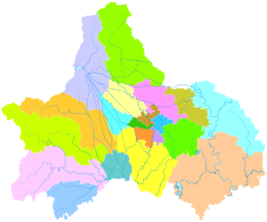
Pujiang County jurisdiction over 2 streets and 6 towns.[3] Pujiang County People's Government is located in Government Street No. 31, Heshan Subdistrict.
- subdistrict
- Heshan Subdistrict (鹤山街道)
- Shouan Subdistrict (寿安街道)
- Towns
- Datang town (大塘镇)
- Zhaoyanghu town (朝阳湖镇)
- Xilai town (西来镇)
- Daxing town (大兴镇)
- Ganxi town (甘溪镇)
- Chengjia town (成佳镇)
Pujiang County is in the Southwest part of the Sichuan Basin and in the area from East longitude 103°19′to 103°41′ and from North latitude 30°05′ to 30°20′. It borders Pengshan and Meishan in the east, Mingshan in the west, Danlin (Danleng County) in the south, and Qionglai City in the north, stretching 37 kilometers from east to west and 27.5 kilometers from north to south.
In the 4th century BC the Qin Kingdom annexed the Shu Kingdom and established Puyang county in the Pushui area. In the Han Dynasty, Puyang county was eliminated and affiliated with Linyi county. In 554 AD, it was built as Guangding county and in 601 AD the name was changed to Pujiang. The county was originally located in Lixudi in the north and during the Hongwu Emperor reign, the emperor moved the county to what is now Heshan town under the jurisdiction of Qiongzhou, and later under Meishan, then Wenjiang. In 1983 it was put under the administration of the city of Chengdu.
The urban district, Pujiang Centralized Area for Industrial Development, is near to Chendu-Ya'an Highway, 68 kilometers from Chengdu. The area is the only processing center for agriculture by-products at the state level in Chengdu. The size is approximately 6 square kilometers and the shorter-term development area is 5.4 square kilometers. Its emphasis is on developing food drinking biology, medicine, light industry, manufacturing, and other high technology ventures.
| Climate data for Pujiang, elevation 578 m (1,896 ft), (1991–2020 normals, extremes 1981–2010) | |||||||||||||
|---|---|---|---|---|---|---|---|---|---|---|---|---|---|
| Month | Jan | Feb | Mar | Apr | May | Jun | Jul | Aug | Sep | Oct | Nov | Dec | Year |
| Record high °C (°F) | 18.8 (65.8) |
24.2 (75.6) |
32.9 (91.2) |
32.9 (91.2) |
35.1 (95.2) |
37.8 (100.0) |
37.2 (99.0) |
38.1 (100.6) |
36.1 (97.0) |
30.3 (86.5) |
26.6 (79.9) |
18.8 (65.8) |
38.1 (100.6) |
| Mean daily maximum °C (°F) | 9.6 (49.3) |
12.4 (54.3) |
17.3 (63.1) |
23.0 (73.4) |
26.7 (80.1) |
28.9 (84.0) |
30.6 (87.1) |
30.4 (86.7) |
25.9 (78.6) |
20.9 (69.6) |
16.4 (61.5) |
11.0 (51.8) |
21.1 (70.0) |
| Daily mean °C (°F) | 6.0 (42.8) |
8.3 (46.9) |
12.3 (54.1) |
17.3 (63.1) |
21.0 (69.8) |
23.7 (74.7) |
25.5 (77.9) |
25.1 (77.2) |
21.5 (70.7) |
17.2 (63.0) |
12.7 (54.9) |
7.5 (45.5) |
16.5 (61.7) |
| Mean daily minimum °C (°F) | 3.6 (38.5) |
5.6 (42.1) |
8.9 (48.0) |
13.3 (55.9) |
17.1 (62.8) |
20.2 (68.4) |
22.1 (71.8) |
21.8 (71.2) |
19.1 (66.4) |
15.0 (59.0) |
10.3 (50.5) |
5.2 (41.4) |
13.5 (56.3) |
| Record low °C (°F) | −4.5 (23.9) |
−2.9 (26.8) |
−0.6 (30.9) |
4.5 (40.1) |
7.8 (46.0) |
14.2 (57.6) |
16.0 (60.8) |
15.7 (60.3) |
12.3 (54.1) |
4.5 (40.1) |
−0.7 (30.7) |
−4.5 (23.9) |
−4.5 (23.9) |
| Average precipitation mm (inches) | 14.5 (0.57) |
21.9 (0.86) |
38.8 (1.53) |
71.5 (2.81) |
106.5 (4.19) |
133.6 (5.26) |
258.5 (10.18) |
289.3 (11.39) |
146.6 (5.77) |
72.0 (2.83) |
28.4 (1.12) |
15.8 (0.62) |
1,197.4 (47.13) |
| Average precipitation days (≥ 0.1 mm) | 10.3 | 10.6 | 13.1 | 14.3 | 15.3 | 16.8 | 16.8 | 16.6 | 17.1 | 17.1 | 10.9 | 9.4 | 168.3 |
| Average snowy days | 1.2 | 0.3 | 0 | 0 | 0 | 0 | 0 | 0 | 0 | 0 | 0 | 0.2 | 1.7 |
| Average relative humidity (%) | 85 | 83 | 81 | 79 | 77 | 81 | 84 | 85 | 86 | 87 | 86 | 86 | 83 |
| Mean monthly sunshine hours | 43.2 | 51.6 | 82.5 | 113.6 | 124.0 | 114.9 | 130.2 | 139.3 | 71.7 | 52.0 | 52.5 | 43.8 | 1,019.3 |
| Percent possible sunshine | 13 | 16 | 22 | 29 | 29 | 27 | 31 | 34 | 20 | 15 | 17 | 14 | 22 |
| Source: China Meteorological Administration[4][5] | |||||||||||||
- Google (2014-07-02). "Pujiang" (Map). Google Maps. Google. Retrieved 2014-07-02.
- 我市2010年第六次全国人口普查数据公报 (in Simplified Chinese). Government of Chengdu. 2011-05-13. Retrieved 2011-08-04.
- 2023年统计用区划代码和城乡划分代码:蒲江县 (in Simplified Chinese). National Bureau of Statistics of China.
- 中国气象数据网 – WeatherBk Data (in Simplified Chinese). China Meteorological Administration. Retrieved 14 April 2023.
- 中国气象数据网 (in Simplified Chinese). China Meteorological Administration. Retrieved 14 April 2023.
- Official gov't website
- "2,500-year-old Boat Coffin Reveals Hidden History", Xinhua News Agency, December 15, 2006."With abundant cultural relics, a boat-shaped coffin dating back nearly 2,500 years has been unearthed in Feilong Village near Heshan Town in Sichuan's Pujiang County, raising expectations that it may reveal the true history of a long-lost kingdom in the area."