Puerto_Rico_Highway_690
Puerto Rico Highway 690
Highway in Puerto Rico
Puerto Rico Highway 690 (PR-690) is a north–south road located entirely in the municipality of Vega Alta, Puerto Rico.[3] With a length of 7.6 kilometers (4.7 mi),[1] it begins at its junction with PR-676 in Bajura barrio and ends at Cerro Gordo Beach in Sabana barrio.[4][5]
- Puerto Rico Highway 690
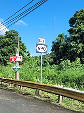
- Heading south in Bajura barrio
- Heading south in Sabana barrio
Quick Facts Highway 690, Route information ...
| Ruta 690 | ||||
| Route information | ||||
| Maintained by Puerto Rico DTPW | ||||
| Length | 7.6 km[1] (4.7 mi) | |||
| Existed | 1953[2]–present | |||
| Major junctions | ||||
| South end | ||||
| Major intersections | ||||
| North end | Calle Principal in Sabana | |||
| Location | ||||
| Country | United States | |||
| Territory | Puerto Rico | |||
| Municipalities | Vega Alta | |||
| Highway system | ||||
| ||||
| ||||
Close
The entire route is located in Vega Alta.
 PR-2 west near PR-690 junction in Bajura barrio
 PR-2 west at PR-690 junction in Bajura barrio
.jpg)
.jpg)
.jpg)
.jpg)
More information Location, km ...
| Location | km[1] | mi | Destinations | Notes | |
|---|---|---|---|---|---|
| Bajura | 0.0 | 0.0 | Southern terminus of PR-690 | ||
| 0.2 | 0.12 | ||||
| Sabana | 1.1 | 0.68 | PR-22 exit 31; one-way ramp; PR-22 access via PR-2 west | ||
| 2.2– 2.3 | 1.4– 1.4 | ||||
| 4.4 | 2.7 | ||||
| 5.2– 5.3 | 3.2– 3.3 | ||||
| 5.9 | 3.7 | ||||
| 6.0 | 3.7 | ||||
| 7.2 | 4.5 | ||||
| 7.6 | 4.7 | PR-Calle Principal – Sabana | Northern terminus of PR-690 | ||
| 1.000 mi = 1.609 km; 1.000 km = 0.621 mi | |||||
Close
Puerto Rico Highway 6690 (PR-6690) is a spur route that goes to PR-693 from PR-690 near Cerro Gordo Beach.[7] The entire route is located in Sabana, Vega Alta.
- Google (20 March 2021). "PR-690" (Map). Google Maps. Google. Retrieved 20 March 2021.
- "Vega Alta, Memoria Núm. 59" (PDF) (in Spanish). Puerto Rico Planning Board. 1955. Retrieved 7 May 2021.
- National Geographic Maps (2011). Puerto Rico (Map). 1:125,000. Adventure Map (Book 3107). Evergreen, Colorado: National Geographic Maps. ISBN 978-1566955188. OCLC 756511572.
- "Tránsito Promedio Diario (AADT)". Datos de Tránsito [Transit Data] (in Spanish). Puerto Rico Department of Transportation and Public Works. p. 123. Archived from the original on 1 April 2019. Retrieved 16 May 2021.
- "PR-690, Vega Alta, Puerto Rico". geoview.info. Retrieved 16 May 2021.
- "PR-6690, Vega Alta, Puerto Rico". geoview.info. Retrieved 16 May 2021.
 Media related to Puerto Rico Highway 690 and Puerto Rico Highway 6690 at Wikimedia Commons
This Vega Alta, Puerto Rico location article is a stub. You can help Wikipedia by expanding it. |
This Puerto Rico road-related article is a stub. You can help Wikipedia by expanding it. |