Puerto_Rico_Highway_4110
Puerto Rico Highway 110
Highway in Puerto Rico
Puerto Rico Highway 110 (PR-110) is a road that goes from Añasco, Puerto Rico to Aguadilla through Moca.[3] It extends from Puerto Rico Highway 2 north of Añasco to Ramey Air Force Base.[4]
| Ruta 110 | ||||||||||||||
| Route information | ||||||||||||||
| Maintained by Puerto Rico DTPW | ||||||||||||||
| Length | 33.0 km[1][2] (20.5 mi) | |||||||||||||
| Major junctions | ||||||||||||||
| South end | ||||||||||||||
| Major intersections |
| |||||||||||||
| North end | Ramey Air Force Base in Maleza Alta | |||||||||||||
| Location | ||||||||||||||
| Country | United States | |||||||||||||
| Territory | Puerto Rico | |||||||||||||
| Municipalities | Añasco, Aguada, Moca, Aguadilla | |||||||||||||
| Highway system | ||||||||||||||
| ||||||||||||||
| ||||||||||||||
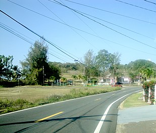 PR-110 and PR-462 between Moca and Aguadilla

| Municipality | Location | km[1][2] | mi | Destinations | Notes |
|---|---|---|---|---|---|
| Añasco | Quebrada Larga | 0.0 | 0.0 | Southern terminus of PR-110 | |
| Aguada–Moca municipal line | Cerro Gordo–Naranjo line | 2.3 | 1.4 | ||
| Aguada | Cerro Gordo | 4.8 | 3.0 | ||
| Aguada–Moca municipal line | Cerro Gordo–Marías line | 5.1 | 3.2 | ||
| Mamey–Marías line | 8.9 | 5.5 | |||
| Moca | Pueblo | 11.7 | 7.3 | Former PR-110R | |
| Pueblo–Moca barrio-pueblo line | 12.5 | 7.8 | |||
| Moca barrio-pueblo | 12.7 | 7.9 | |||
| Pueblo | 13.3 | 8.3 | Former PR-110R | ||
| Centro | 17.2 | 10.7 | |||
| Aguadilla–Moca municipal line | Caimital Alto–Centro line | 19.8 | 12.3 | ||
| Moca | Aceitunas | 21.4 | 13.3 | ||
| Aguadilla | Ceiba Baja | 23.1 118.3[lower-alpha 1] | 14.4 73.5 | Eastern terminus of PR-2 concurrency | |
| Caimital Alto–Ceiba Baja line | 119.5[lower-alpha 1] 23.2 | 74.3 14.4 | Western terminus of PR-2 concurrency | ||
| 23.3– 23.4 | 14.5– 14.5 | ||||
| Arenales–Aguacate line | 27.0 | 16.8 | |||
| Aguacate | 27.4– 27.5 | 17.0– 17.1 | Former PR-110R | ||
| Montaña | 29.3 | 18.2 | |||
| 30.2 | 18.8 | ||||
| Maleza Alta | 33.0 | 20.5 | PR-Cliff Road / PR-San Antonio Road – Ramey Air Force Base | Northern terminus of PR-110 | |
1.000 mi = 1.609 km; 1.000 km = 0.621 mi
| |||||
- Kilometer markers represent the distance along PR-2 rather than PR-110.
Currently, PR-110 has two branches in its old segments in Aguadilla and Moca and it also has another one between the two municipalities.[3]
Puerto Rico Highway 110R
Puerto Rico Highway 110R (Spanish: Carretera Ramal 110, abbreviated Ramal PR-110 or PR-110R) was the old section of PR-110 through downtown Moca. This road can be seen as a Business 110,[3] but currently is renumbered to PR-4025.[6] The entire route is located in Moca.
| Location | km[5] | mi | Destinations | Notes | |
|---|---|---|---|---|---|
| Pueblo | 0.0 | 0.0 | Southern terminus of PR-110R | ||
| Moca barrio-pueblo | 1.0 | 0.62 | One-way street; eastbound access via Calle Don Chemary | ||
| Pueblo | 1.5 | 0.93 | Northern terminus of PR-110R | ||
| 1.000 mi = 1.609 km; 1.000 km = 0.621 mi | |||||
Puerto Rico Highway 4010
Puerto Rico Highway 4010 (PR-4010) is an old segment of PR-110 that provides access to a small residential area between Aguacate and Maleza Alta in Aguadilla. Previously it was identified as PR-110R.[3] The entire route is located in Aguadilla.
| Location | km[7] | mi | Destinations | Notes | |
|---|---|---|---|---|---|
| Aguacate | 0.0 | 0.0 | Southern terminus of PR-4010 | ||
| Maleza Alta–Aguacate line | 0.7 | 0.43 | |||
| Maleza Alta | 1.4 | 0.87 | [[Puerto Rico Highway Ramey Air Force Base |PR-Ramey Air Force Base]] – Aguadilla | Northern terminus of PR-4010; dead end road | |
| 1.000 mi = 1.609 km; 1.000 km = 0.621 mi | |||||
Puerto Rico Highway 4110
Puerto Rico Highway 4110 (PR-4110) is a spur route of PR-110 between Moca and Aguadilla. It extends from PR-110 to PR-443.[3]
| Municipality | Location | km[8] | mi | Destinations | Notes |
|---|---|---|---|---|---|
| Aguadilla | Caimital Bajo–Caimital Alto line | 0.9 | 0.56 | Western terminus of PR-4110 | |
| Moca | Centro | 0.0 | 0.0 | Eastern terminus of PR-4110 | |
| 1.000 mi = 1.609 km; 1.000 km = 0.621 mi | |||||
- Google (25 March 2020). "PR-110 south" (Map). Google Maps. Google. Retrieved 25 March 2020.
- Google (25 March 2020). "PR-110 north" (Map). Google Maps. Google. Retrieved 25 March 2020.
- National Geographic Maps (2011). Puerto Rico (Map). 1:125,000. Adventure Map (Book 3107). Evergreen, Colorado: National Geographic Maps. ISBN 978-1566955188. OCLC 756511572.
- "Tránsito Promedio Diario (AADT)". Transit Data (Datos de Transito) (in Spanish). DTOP PR. pp. 60–61. Archived from the original on 1 April 2019.
- Google (1 March 2020). "PR-110R" (Map). Google Maps. Google. Retrieved 1 March 2020.
- "Mapa de Calificación de Suelos de Moca" (PDF). Junta de Planificación (in Spanish). Retrieved 12 January 2022.
- Google (1 March 2020). "PR-4010" (Map). Google Maps. Google. Retrieved 1 March 2020.
- Google (1 March 2020). "PR-4110" (Map). Google Maps. Google. Retrieved 1 March 2020.
 Media related to Puerto Rico Highway 110, Puerto Rico Highway 110R, Puerto Rico Highway 4010 and Puerto Rico Highway 4110 at Wikimedia Commons
- DTOP anuncia cierre por emergencia de la PR-110 entre Aguada a Moca (in Spanish)
This Puerto Rico road-related article is a stub. You can help Wikipedia by expanding it. |