| Marker title |
Image |
Date dedicated |
Location |
Marker type |
Topics |
|---|
| Beaver County |
 |
July 5, 1982 |
County Courthouse, at park on 3rd Street (PA 68), Beaver(MISSING)
|
City |
Business & Industry, Government & Politics, Government & Politics 19th Century, Transportation |
| Fort McIntosh |
 |
October 31, 1946 |
3rd Street (PA 68) at Insurance Street, Beaver
40.69479°N 80.30601°W / 40.69479; -80.30601 (Fort McIntosh) |
Roadside |
American Revolution, Forts, Military |
| Harmony Society Cemetery |
 |
December 2, 1963 |
Church Street & 11th Street, center of cemetery, Ambridge
40.59304°N 80.23217°W / 40.59304; -80.23217 (Harmony Society Cemetery) |
City |
Religion |
| Harmony Society Church |
 |
September 11, 1967 |
Church Street near Creese Street, Ambridge
40.59605°N 80.23218°W / 40.59605; -80.23218 (Harmony Society Church) |
City |
Buildings, Religion |
| Ingram-Richardson Manufacturing Co. |
 |
May 4, 2001 |
24th Street Extension and 31st Street Extension, Beaver Falls
40.7704°N 80.328°W / 40.7704; -80.328 (Ingram-Richardson Manufacturing Co.) |
Roadside |
Business & Industry |
| King Beaver's Town |
 |
September 25, 1946 |
3rd Street (PA 68) at Wilson Avenue, Beaver
40.69742°N 80.29964°W / 40.69742; -80.29964 (King Beaver's Town) |
Roadside |
Cities & Towns, Government & Politics, Government & Politics 18th Century, Native American |
| Legionville |
 |
September 25, 1946 |
Duss Avenue at Anthony Wayne Drive north of Ambridge
40.62488°N 80.22926°W / 40.62488; -80.22926 (Legionville) |
Roadside |
American Revolution, Cities & Towns, Military, Native American |
| Legionville |
 |
September 25, 1946 |
Duss Avenue at Anthony Wayne Drive, north of Ambridge (MISSING)
|
Roadside |
American Revolution, Military |
| Logstown |
 |
October 31, 1946 |
Duss Avenue at Anthony Wayne Drive, north of Ambridge
40.62283°N 80.2265°W / 40.62283; -80.2265 (Logstown) |
Roadside |
Cities & Towns, Early Settlement, French & Indian War, Government & Politics, Government & Politics 18th Century, Native American |
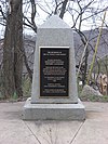
| Logstown - PLAQUE |
|
June 1, 1918 |
Duss Avenue at Anthony Wayne Drive, north of Ambridge (MISSING)
40.6228°N 79.7734°W / 40.6228; -79.7734 (Logstown - PLAQUE) |
Plaque |
Early Settlement, French & Indian War, Native American |
| Matthew S. Quay |
 |
July 22, 1949 |
3rd Street (PA 68) at Insurance Street, Beaver
40.69464°N 80.30617°W / 40.69464; -80.30617 (Matthew S. Quay) |
Roadside |
Government & Politics, Government & Politics 19th Century |
| NLRB v. Jones & Laughlin Supreme Court Ruling |
 |
April 8, 2000 |
112 Station Street, Aliquippa
40.61964°N 80.2428°W / 40.61964; -80.2428 (NLRB v. Jones & Laughlin Supreme Court Ruling) |
Roadside |
Government & Politics 20th Century, Labor |
| Old Economy |
 |
n/a |
PA 65 in Ambridge, across from site
40.59565°N 80.23218°W / 40.59565; -80.23218 (Old Economy) |
Roadside |
Religion |
| Old Economy Memorial |
 |
n/a |
Old Economy, 13th & Church Streets, Ambridge
40.59585°N 80.23373°W / 40.59585; -80.23373 (Old Economy Memorial) |
Roadside |
Religion |
| Pennsylvania |
 |
March 25, 1949 |
US 30, .4 miles from state line (MISSING)
|
Roadside |
Government & Politics, Government & Politics 17th Century, William Penn |
| Pennsylvania |
 |
March 25, 1949 |
PA 68 at state line (MISSING)
|
Roadside |
Government & Politics, Government & Politics 17th Century, William Penn |
| White Cottage |
 |
May 27, 1969 |
1221 3rd Avenue (PA 65/18), New Brighton
40.73084°N 80.31003°W / 40.73084; -80.31003 (White Cottage) |
City |
Houses & Homesteads, Women, Writers |


