Drumkee

Drumkee

Drumkee

Townland in County Tyrone, Northern Ireland


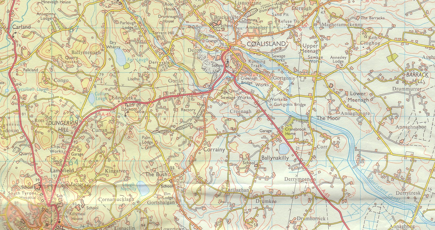
Drumkee is a townland in the southeast of County Tyrone, Northern Ireland. It is directly south of the area presently known as Coalisland[1] and east, and slightly north, of Dungannon.[2] It is situated in the historic barony of Dungannon Middle and the civil parish of Killyman and covers an area of 285 acres.[3] The barony's tax records dated 1666 list two families living in Drumkee.[4]

Quick Facts County, Country ...

The name derives from the Irish: Druim Chaoich (Ridge of the Blind Man) or Druim Ceath (ridge of western aspect).[5]

Population

The population of the townland declined during the 19th century:[6][7]

More information Year ...

Drumkee presently has a population of around 150, and many of its inhabitants are relations.[citation needed] Surnames which appear on the 1666 list include McRory and Condson.[4] By the mid-19th century, the name Hunter appears in Drumkee burial records.[8] The surname Mullan appears in a 1910 directory of the area.[9]

See also


References

  1. Coalisland Map. Accessed July 11, 2007.
  2. Dungannon LGD Killyman Ward 95OO17 map from the Northern Ireland Neighbourhood Information Service. Accessed July 11, 2007.
  3. "Townlands of County Tyrone". IreAtlas Townland Database. Retrieved 27 December 2012.
  4. "Drumkee". Place Names NI. Retrieved 20 March 2013.
  5. "Census of Ireland 1851". Enhanced Parliamentary Papers on Ireland. Retrieved 27 December 2012.[permanent dead link]
  6. "Census of Ireland 1891". Enhanced Parliamentary Papers on Ireland. Retrieved 27 December 2012.[permanent dead link]
  7. Killyman Burial Records. Accessed July 11, 2007.

Share this article:

This article uses material from the Wikipedia article Drumkee, and is written by contributors. Text is available under a CC BY-SA 4.0 International License; additional terms may apply. Images, videos and audio are available under their respective licenses.