Dalhart_Municipal_Airport

Dalhart Municipal Airport

Dalhart Municipal Airport

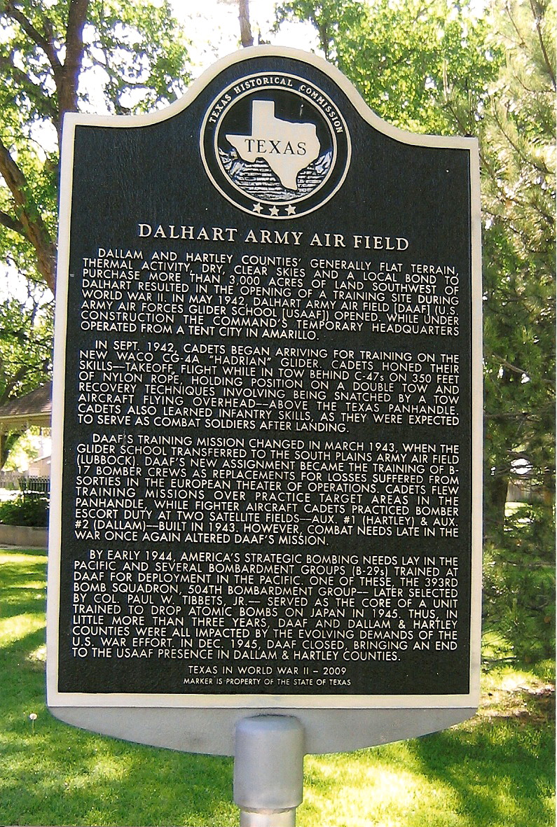
Airport in near Dalhart, Texas


Dalhart Municipal Airport (IATA: DHT, ICAO: KDHT, FAA LID: DHT) is in unincorporated Hartley County, Texas,[2] three miles (5 km) southwest of Dalhart, Texas,[1] a city straddling the border of Dallam and Hartley counties in the northwest corner of the Texas Panhandle.[3]

Quick Facts Summary, Airport type ...

The airport sees no airlines.

Facilities

The airport covers 1,206 acres (488 ha) and has two asphalt runways: 3/21 is 5,440 x 75 ft (1,658 x 23 m) and 17/35 is 6,400 x 75 ft (1,951 x 23 m).[1]

In the year ending September 16, 2021, the airport had 7,650 aircraft operations, average 21 per day: 65% local general aviation, 33% transient general aviation, and 2% military. 40 aircraft were based at this airport: 33 single-engine, 5 multi-engine, 1 helicopter, and 1 glider.[1]

History

The airport was built by the Army and opened in May 1942 as Dalhart Army Airfield. Initially assigned to Army Air Forces Glider command, while under construction the command's temporary headquarters operated from a tent city in Amarillo.[4]

Dalhart AAF closed in December 1945; the property went to the city. Several remaining buildings have been used as the Dalhart municipal airport.[4]

See also


References

  1. "2020 CENSUS - CENSUS BLOCK MAP: Hartley County, TX" (PDF). U.S. Census Bureau. p. 4 (PDF p. 5/28). Retrieved 2022-08-15. Dalhart Municipal Arprt
  2. "City of Dalhart, Texas". Archived from the original on 2007-10-10. Retrieved 2007-11-07.


Share this article:

This article uses material from the Wikipedia article Dalhart_Municipal_Airport, and is written by contributors. Text is available under a CC BY-SA 4.0 International License; additional terms may apply. Images, videos and audio are available under their respective licenses.