North_Island
North Island
One of the two main New Zealand islands
The North Island, also officially named Te Ika-a-Māui,[1] is one of the two main islands of New Zealand, separated from the larger but less populous South Island by Cook Strait. With an area of 113,729 km2 (43,911 sq mi),[2] it is the world's 14th-largest island, constituting 43% of New Zealand's land area. It has a population of 3,997,300 (June 2023),[3] which is 77% of New Zealand's residents,[4] making it the most populous island in Polynesia and the 28th-most-populous island in the world.
| Geography | |
|---|---|
| Location | Oceania |
| Coordinates | 39°S 176°E |
| Archipelago | New Zealand |
| Area | 113,729 km2 (43,911 sq mi) |
| Area rank | 14th |
| Highest elevation | 2,797 m (9177 ft) |
| Highest point | Mount Ruapehu |
| Administration | |
New Zealand | |
| ISO 3166-2:NZ | NZ-N |
| Regions | 9 |
| Territorial authorities | 43 |
| Largest settlement | Auckland (pop. 1,478,800) |
| Demographics | |
| Population | 3,997,300 (June 2023) |
| Pop. density | 35.1/km2 (90.9/sq mi) |
Twelve main urban areas (half of them officially cities) are in the North Island. From north to south, they are Whangārei, Auckland, Hamilton, Tauranga, Rotorua, Gisborne, New Plymouth, Napier, Hastings, Whanganui, Palmerston North, and New Zealand's capital city Wellington, which is located at the south-west tip of the island.
Although the island has been known as the North Island for many years, the Māori name for it is Te Ika-a-Māui. On some 19th-century maps, the North Island is named New Ulster, which was also a province of New Zealand that included the North Island. In 2009 the New Zealand Geographic Board found that, along with the South Island, the North Island had no official name.[5] After a public consultation, the board officially named it North Island, or the aforementioned Te Ika-a-Māui, in October 2013.[6]
In prose, the two main islands of New Zealand are called the North Island and the South Island, with the definite article.[7] It is also normal to use the preposition in rather than on, for example "Hamilton is in the North Island", "my mother lives in the North Island".[8] Maps, headings, tables, and adjectival expressions use North Island without "the".
According to Māori mythology, the North and South Islands of New Zealand arose through the actions of the demigod Māui. Māui and his brothers were fishing from their canoe (the South Island) when he caught a great fish and pulled it right up from the sea. While he was not looking, his brothers fought over the fish and chopped it up. This great fish became the North Island, and thus a Māori name for the North Island is Te Ika-a-Māui ("The Fish of Māui").[9] The mountains and valleys are believed to have been formed as a result of Māui's brothers' hacking at the fish.
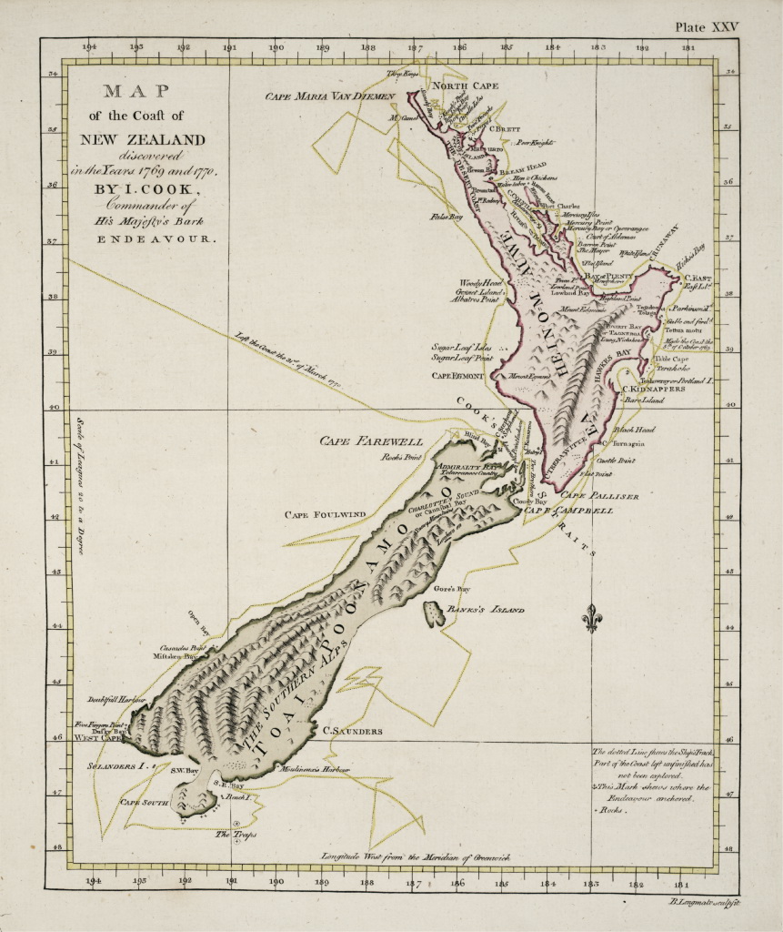
During Captain James Cook's voyage between 1769 and 1770, Tahitian navigator Tupaia accompanied the circumnavigation of New Zealand. The maps described the North Island as "Ea Heinom Auwe" and "Aeheinomowe", which recognises the "Fish of Māui" element.
Another Māori name that was given to the North Island, but is now used less commonly, is Aotearoa. Use of Aotearoa to describe the North Island fell out of favour in the early 20th century, and it is now a collective Māori name for New Zealand as a whole.[10][11]
During the Last Glacial Period when sea levels were over 100 metres lower than present day levels, the North and South islands were connected by a vast coastal plain which formed at the South Taranaki Bight.[12] During this period, most of the North Island was covered in thorn scrubland and forest, while the modern-day Northland Peninsula was a subtropical rainforest.[13] Sea levels began to rise 7,000 years ago, eventually separating the islands and linking the Cook Strait to the Tasman Sea.[12]
Bays and coastal features
Lakes and rivers
Capes and peninsulas
Forests and national parks
.JPG)
.jpg)
Volcanology
Other
The North Island has an estimated population of 3,997,300 as of June 2023.[3]
Ever since the conclusion of the Otago Goldrush in the 1860s, New Zealand's European population growth has experienced a steady 'Northern drift' as population centres in the North Island have grown faster than those of New Zealand's South Island. This population trend has continued into the twenty-first century, but at a much slower rate. While the North Island's population continues to grow faster than the South Island, this is solely due to the North Island having higher natural increase (i.e. births minus deaths) and international migration; since the late 1980s, the internal migration flow has been from the North Island to the South Island.[14] In the year to June 2020, the North Island gained 21,950 people from natural increase and 62,710 people from international migration, while losing 3,570 people from internal migration.[15]
Culture and identity
At the 2018 New Zealand census, 65.7% of North Islanders identified as of European ethnicity, 18.5% as Māori, 17.0% as Asian, 9.7% as Pasifika, 1.6% as Middle Eastern/Latin American/African, and 1.2% as another ethnicity (mainly 'New Zealander'). Totals add to more than 100% since people may identify with multiple ethnicities.[16]
The proportion of North Islanders born overseas is 29.3%. The most common foreign countries of birth are England (15.4% of overseas-born residents), Mainland China (11.3%), India (10.1%), South Africa (5.9%), Australia (5.5%) and Samoa (5.3%).[17]
Cities and towns
The North Island has a larger population than the South Island, with the country's largest city, Auckland, and the capital, Wellington, accounting for nearly half of it.
There are 30 urban areas in the North Island with a population of 10,000 or more:
| Name | Population (June 2023)[3] |
% of island |
|---|---|---|
| Auckland | 1,478,800 | 37.0% |
| Wellington | 215,200 | 5.4% |
| Hamilton | 185,300 | 4.6% |
| Tauranga | 161,800 | 4.0% |
| Lower Hutt | 113,000 | 2.8% |
| Palmerston North | 82,500 | 2.1% |
| Napier | 67,500 | 1.7% |
| Porirua | 60,900 | 1.5% |
| Hibiscus Coast | 63,400 | 1.6% |
| New Plymouth | 59,600 | 1.5% |
| Rotorua | 58,900 | 1.5% |
| Whangārei | 56,900 | 1.4% |
| Hastings | 51,500 | 1.3% |
| Upper Hutt | 45,400 | 1.1% |
| Whanganui | 42,800 | 1.1% |
| Gisborne | 38,200 | 1.0% |
| Paraparaumu | 30,800 | 0.8% |
| Pukekohe | 27,400 | 0.7% |
| Taupō | 26,500 | 0.7% |
| Masterton | 22,600 | 0.6% |
| Cambridge | 21,800 | 0.5% |
| Levin | 19,800 | 0.5% |
| Feilding | 17,750 | 0.4% |
| Whakatāne | 16,850 | 0.4% |
| Havelock North | 15,200 | 0.4% |
| Tokoroa | 14,500 | 0.4% |
| Waikanae | 13,150 | 0.3% |
| Te Awamutu | 14,000 | 0.4% |
| Hāwera | 10,350 | 0.3% |
| Te Puke | 10,250 | 0.3% |
The sub-national GDP of the North Island was estimated at NZ$ 282.355 billion in 2021 (78% of New Zealand's national GDP).[18]
Regions
Nine local government regions cover the North Island and its adjacent islands and territorial waters.
Healthcare in the North Island is provided by fifteen District Health Boards (DHBs). Organised around geographical areas of varying population sizes, they are not coterminous with the Local Government Regions.
- "Two official options for NZ island names". The New Zealand Herald. APNZ. 10 October 2013. Retrieved 20 December 2018.
- "Quick Facts – Land and Environment : Geography – Physical Features". Statistics New Zealand. 2000. Archived from the original on 8 April 2013. Retrieved 13 August 2012.
- "Subnational population estimates (RC, SA2), by age and sex, at 30 June 1996-2023 (2023 boundaries)". Statistics New Zealand. Retrieved 25 October 2023. (regional councils); "Subnational population estimates (TA, SA2), by age and sex, at 30 June 1996-2023 (2023 boundaries)". Statistics New Zealand. Retrieved 25 October 2023. (territorial authorities); "Subnational population estimates (urban rural), by age and sex, at 30 June 1996-2023 (2023 boundaries)". Statistics New Zealand. Retrieved 25 October 2023. (urban areas)
- "77% of NZers live in North Island". RNZ. 26 October 2017. Retrieved 19 November 2021.
- "The New Zealand Geographic Board Considers North and South Island Names". Land Information New Zealand. 21 April 2009. Archived from the original on 14 February 2013. Retrieved 28 November 2012.
- "Two official options for NZ island names". The New Zealand Herald. 10 October 2013. Retrieved 10 October 2013.
- Williamson, Maurice (11 October 2013). "Names of NZ's two main islands formalised". Beehive.govt.nz. New Zealand Government. Retrieved 10 April 2020.
- Guardian and Observer style guide: N ("New Zealand"). Archived 21 January 2014 at the Wayback Machine. The Guardian. Retrieved 15 April 2019.
- "1000 Māori place names". New Zealand Ministry for Culture and Heritage. 6 August 2019.
- "Ngāi Tahu leader: Let's not rush name change". RNZ. 2 October 2021. Retrieved 26 September 2022.
- McLintock, Alexander Hare; James Oakley Wilson, D. S. C.; Taonga, New Zealand Ministry for Culture and Heritage Te Manatu. "AOTEAROA". An encyclopaedia of New Zealand, edited by A. H. McLintock, 1966. Retrieved 19 November 2021.
- "Estuary origins". National Institute of Water and Atmospheric Research. Retrieved 3 November 2021.
- Ray, N.; Adams, J.M. (2001). "A GIS-based Vegetation Map of the World at the Last Glacial Maximum (25,000–15,000 BP)". Internet Archaeology. 11 (11). doi:10.11141/ia.11.2.
- "New Zealand's population is drifting north". 26 January 2015. Archived from the original on 26 January 2015. Retrieved 22 February 2021.
- "Subnational population component changes and median age (RC, TA), at 30 June 2018–20 (2020 boundaries)". nzdotstat.stats.govt.nz. Retrieved 18 February 2021.
- "Ethnic group (detailed total response – level 3) by age and sex, for the census usually resident population count, 2006, 2013, and 2018 Censuses (RC, TA, SA2, DHB)". nzdotstat.stats.govt.nz. Retrieved 3 March 2020.
- "Birthplace (detailed), for the census usually resident population count, 2006, 2013, and 2018 Censuses (RC, TA, SA2, DHB)". nzdotstat.stats.govt.nz. Retrieved 18 February 2021.
- "Regional gross domestic product: Year ended March 2022". Statistics New Zealand. 24 March 2023. Retrieved 4 April 2023.
 Media related to North Island, New Zealand at Wikimedia Commons
 North Island travel guide from Wikivoyage