Lake_Charles,_Nova_Scotia

Lake Charles (Nova Scotia)

Lake Charles (Nova Scotia)

Lake in Canada


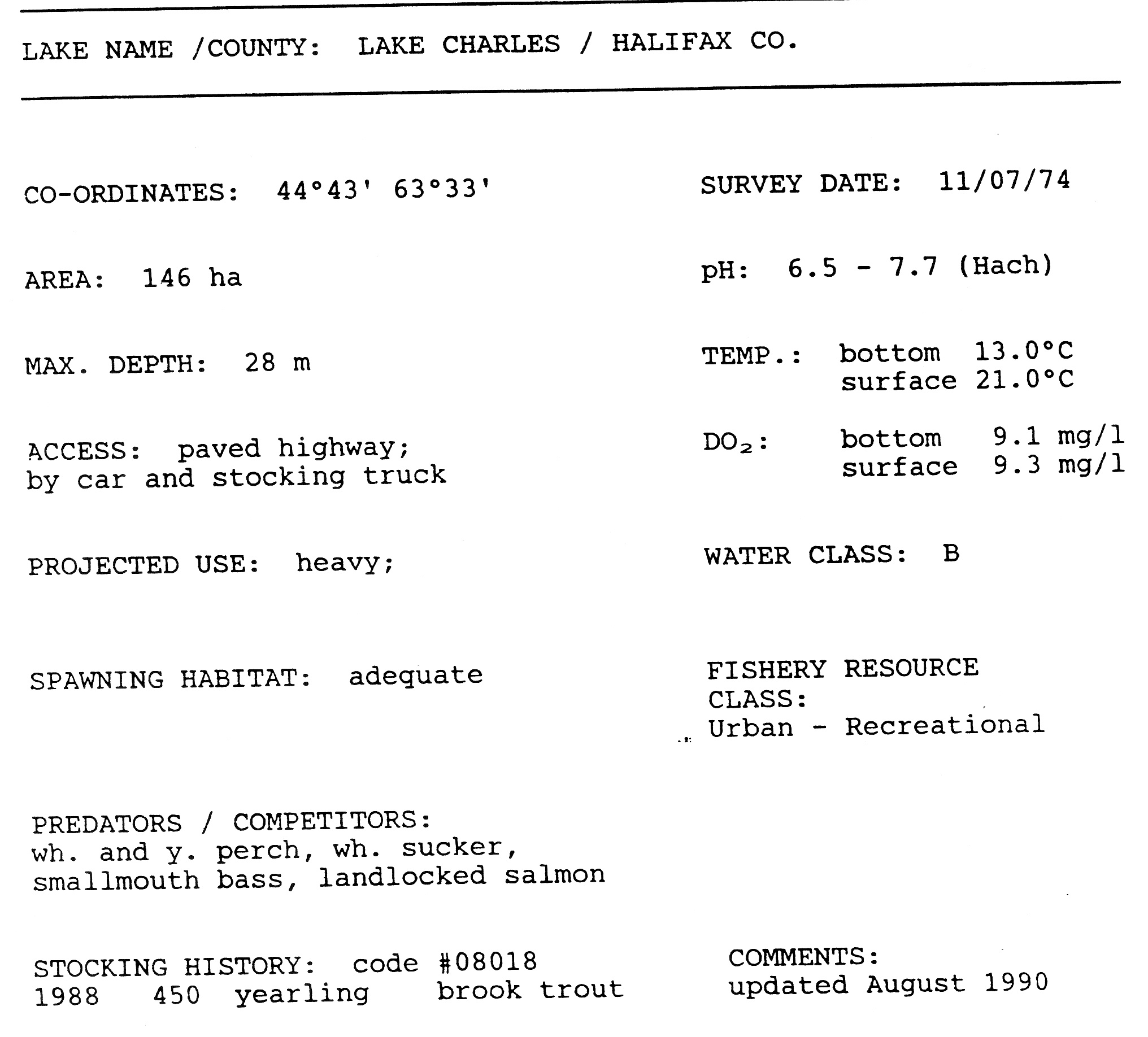
Lake Charles is a small lake in Nova Scotia’s Halifax Regional Municipality between the communities of Dartmouth and Waverley. It is situated between Port Wallace in the south and Nova Scotia Highway 107 in the North, Nova Scotia Highway 118 in the west and Nova Scotia Route 318 to the east. It is the summit of the Shubenacadie Canal, where the level of the surface is 31 m above sea level. Located in the Shubenacadie watershed, it ultimately feeds into the Bay of Fundy. However, it also feeds into Halifax Harbour through the canal locks at Shubie Park.

Quick Facts Location, Coordinates ...

Lake Charles Trail

The Lake Charles Trail, part of the Trans Canada Trail, runs along the western side of the lake, from Shubie Park to the Highway 107 overpass at Route 318 in Portobello. The trail is approximately 4.39 km long, and has a crusher dust surface. The trail is used year-round and is maintained by the Halifax Regional Municipality.

Other Lake Charles in Nova Scotia

References

  • Lake Charles Trail
  • Shubenacadie Canal
  • "Map government of Nova Scotia" (PDF).[permanent dead link] (20.3 KB)
  • Soil & Water Conservation Society of Metro Halifax


Share this article:

This article uses material from the Wikipedia article Lake_Charles,_Nova_Scotia, and is written by contributors. Text is available under a CC BY-SA 4.0 International License; additional terms may apply. Images, videos and audio are available under their respective licenses.