Geologic_province

Geologic province

Geologic province

Spatial entity with common geologic attributes


A geologic province is a spatial entity with common geologic attributes.[1] A province may include a single dominant structural element such as a basin or a fold belt, or a number of contiguous related elements. Adjoining provinces may be similar in structure but be considered separate due to differing histories.
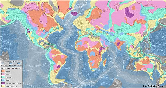
Geologic provinces of the world (USGS)

Geologic provinces by origin

More information Province, Definition ...

Geologic provinces by resources

US coal regions and provinces.

Some studies classify provinces based upon mineral resources, such as mineral deposits. There are a particularly large number of provinces identified worldwide for petroleum and other mineral fuels, such as the Niger Delta petroleum province.

See also


References

  1. "Geologic Province and Thermo-Tectonic Age Maps". Earthquake Hazards Program. United States Geological Survey. Archived from the original on 7 June 2014. Retrieved 6 June 2014.

Share this article:

This article uses material from the Wikipedia article Geologic_province, and is written by contributors. Text is available under a CC BY-SA 4.0 International License; additional terms may apply. Images, videos and audio are available under their respective licenses.