UpHellyAa7(AnneBurgess)30Jan1973.jpg
No higher resolution available.
Summary
| Description |
English:
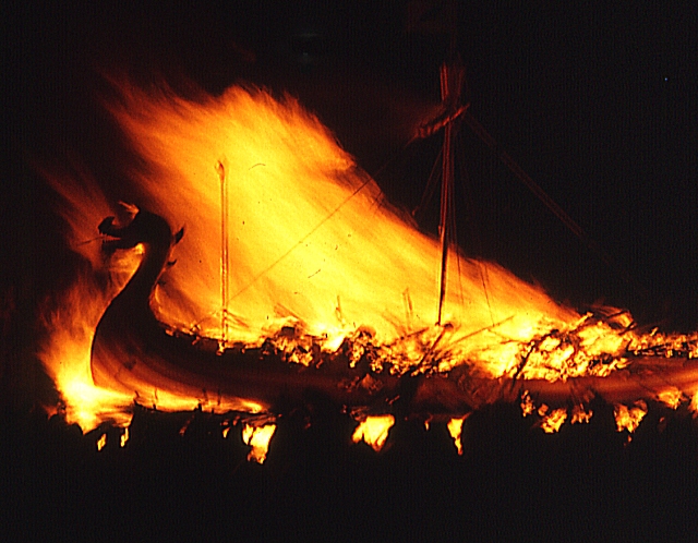
Up Helly Aa (7) - the Burning Galley
Once the galley has burned and the flames die down, a night of partying begins. Any available large room is pressed into service as a hall, presided over by a hostess who issues invitations to attend, and every guiser squad visits every hall in turn to dance and drink with the guests. As there can be dozens of squads and dozens of halls, this takes most of the night and well into the following morning. On the Wednesday, the only thing which moves in Lerwick is the 'hangover bus' taking passengers to the airport at Sumburgh. |
| Date | |
| Source | From geograph.org.uk |
| Author | Anne Burgess |
|
Permission
( Reusing this file ) |
Creative Commons Attribution Share-alike license 2.0 |
| Camera location |
|
View this and other nearby images on: OpenStreetMap |
|
|---|
30Jan1973.jpg¶ms=060.154075_N_-001.148580_E_globe:Earth_type:camera_heading:45.00_source:geograph&language=en)
| Object location |
|
View this and other nearby images on: OpenStreetMap |
|
|---|
30Jan1973.jpg¶ms=060.154120_N_-001.148500_E_globe:Earth_class:object_type:object_source:geograph-osgb36(HU47374137)_region:GB-GBN_heading:45.00&language=en)
Licensing

|
This image was taken from the
Geograph project
collection. See
this photograph's page
on the Geograph website for the photographer's contact details. The copyright on this image is owned by
Anne Burgess
and is licensed for reuse under the
Creative Commons
Attribution-ShareAlike 2.0 license.
|
This file is licensed under the
Creative Commons
Attribution-Share Alike 2.0 Generic
license.
Attribution:
Anne Burgess
-
You are free:
- to share – to copy, distribute and transmit the work
- to remix – to adapt the work
-
Under the following conditions:
- attribution – You must give appropriate credit, provide a link to the license, and indicate if changes were made. You may do so in any reasonable manner, but not in any way that suggests the licensor endorses you or your use.
- share alike – If you remix, transform, or build upon the material, you must distribute your contributions under the same or compatible license as the original.