Seven+Summits+Elevation+World+Map.png
Size of this preview:
800 × 400 pixels
.
Other resolutions:
320 × 160 pixels
|
640 × 320 pixels
|
1,524 × 762 pixels
.
Summary
| Description |
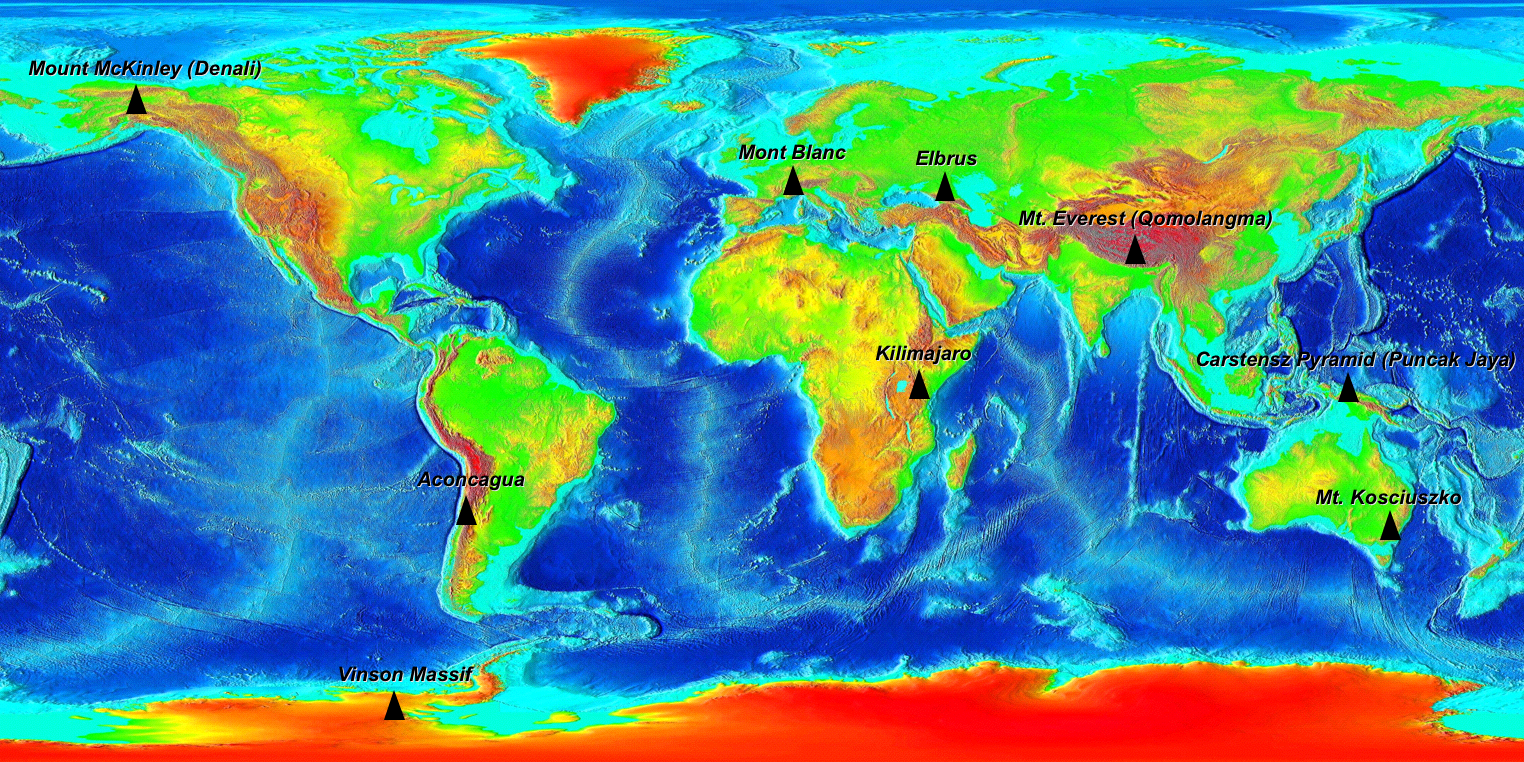
The Seven Summits on an Elevation World Map. (For more information on why 9 peaks are on this map read the wikipedia Seven Summits article.) Elevation key: Green < 500m, Yellow <1000m, Orange <2000m, Red <3000m, Dark Red <5000m, Grey >5000m |
| Date | |
| Source |
Own work based on Image:Elevation.jpg Original file from https://www.ngdc.noaa.gov/mgg/image/2minrelief.html |
| Author |
Base image: National Oceanic and Atmospheric Administration Tagged: Ma xyz |
|
Permission
( Reusing this file ) |
PD |
Licensing
|
|
I, the copyright holder of this work, release this work into the
public domain
. This applies worldwide.
In some countries this may not be legally possible; if so: I grant anyone the right to use this work for any purpose , without any conditions, unless such conditions are required by law. |