Rhein-Ruhr-Region-LEP.png
Size of this preview:
667 × 600 pixels
.
Other resolutions:
267 × 240 pixels
|
534 × 480 pixels
|
854 × 768 pixels
|
1,033 × 929 pixels
.
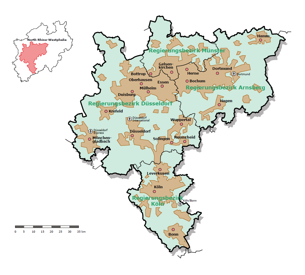
| Description | Map of the Rhein-Ruhr metropolitan region | |||
| Date | ||||
| Source | http://www.brd.nrw.de/BezRegDdorf/hierarchie/themen/Planung_und_Kommunales/Statistische_Daten/m_Die_Zukunft_gehoert_der_Metropolregion.php | |||
| Author | Bezirksregierung Düsseldorf | |||
|
Permission
( Reusing this file ) |
|
|||
| Other versions |
|

