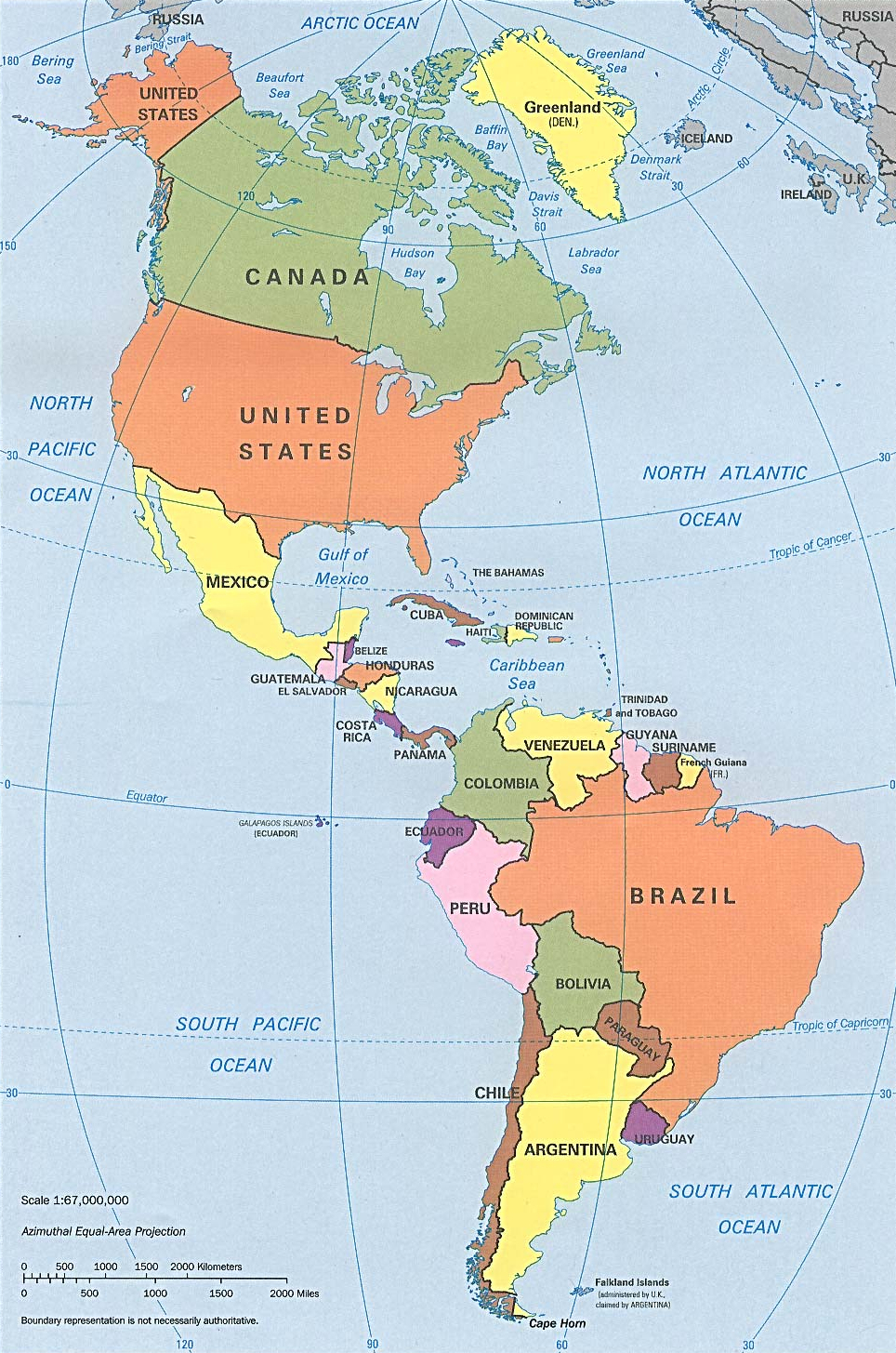
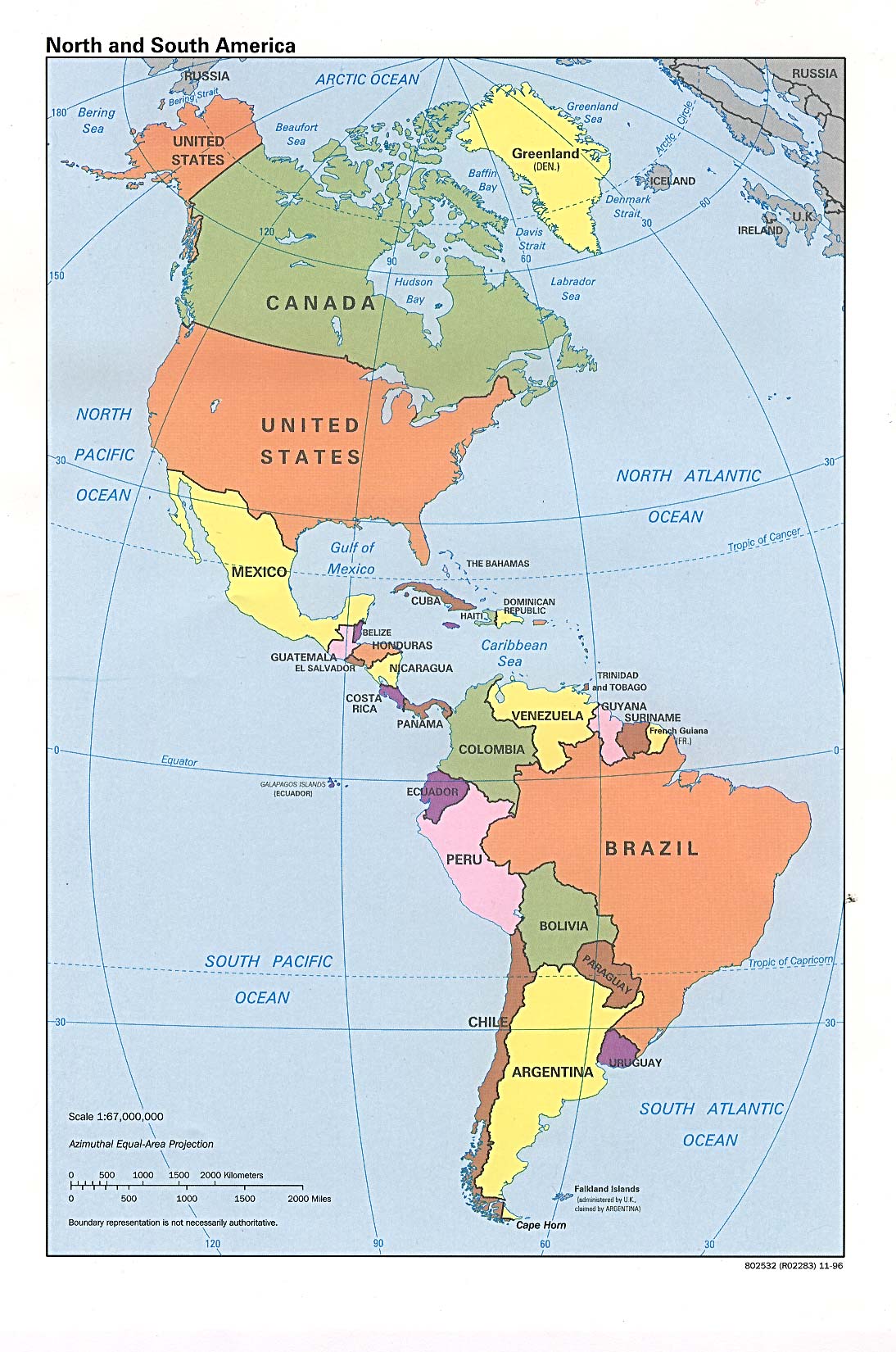
N&SAmerica-pol.jpg
Size of this preview:
397 × 599 pixels
.
Other resolutions:
159 × 240 pixels
|
318 × 480 pixels
|
964 × 1,455 pixels
.
Summary
| Description | Americas with political boundaries |
| Date | |
| Source | http://www.lib.utexas.edu/maps/americas/americas_pol96.jpg |
| Author | CIA, original political map from Perry-Castañeda Library Map Collection ; University of Texas Library Online |
Licensing
|
|
This image is a work of a
Central Intelligence Agency
employee, taken or made as part of that person's official duties. As a Work of the United States Government, this image or media is in the
public domain
in the United States.
|

|