Muizz_Street_-_Egypt.jpg

Size of this preview:
800 × 563 pixels
.
Other resolutions:
320 × 225 pixels
|
640 × 451 pixels
|
1,024 × 721 pixels
|
1,280 × 901 pixels
|
2,560 × 1,802 pixels
|
5,682 × 4,000 pixels
.
Summary
| Description |
English:
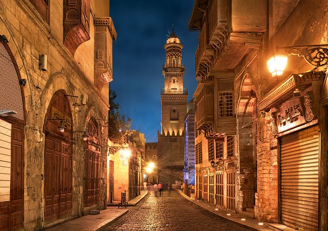
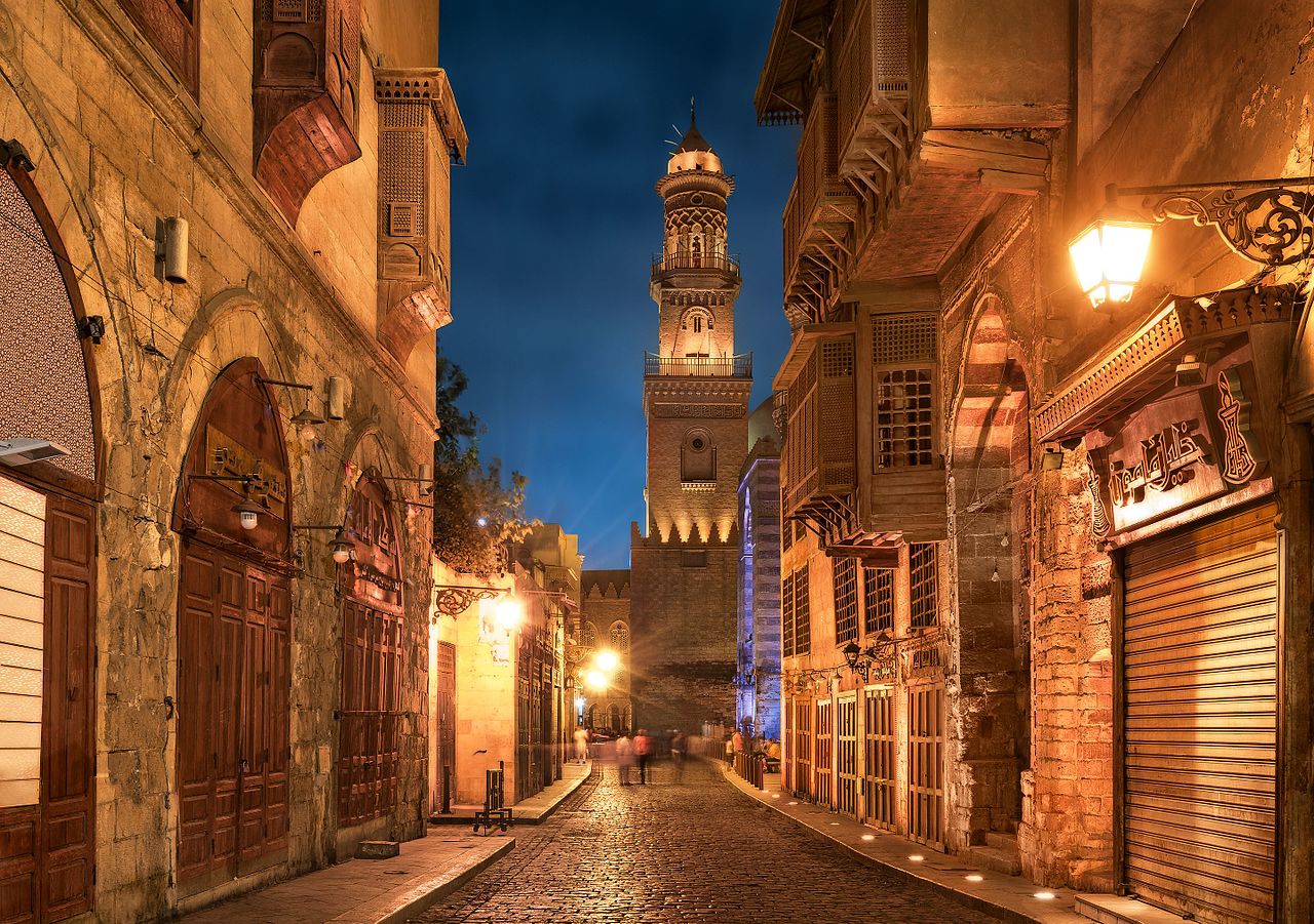
Old cairo between history and future.jpg Essam Azzam St. (Shariʻa al-Muizz li-Deen Illah) (30°02′ 48" N 31°15′ 36"E) in Islamic Cairo, Egypt is one of the oldest streets in Cairo, approximately one kilometer long. A United Nations study found it to have the greatest concentration of medieval architectural treasures in the Islamic world.[1] The street (shariʻa in Arabic) is named for Al-Muʿizz li-Deen Illah, the fourth caliph of the Fatimid dynasty. It stretches from Bab Al-Futuh in the north to Bab Zuweila in the south. Starting in 1997,[2][3] the national government carried out extensive renovations to the historical buildings, modern buildings, paving, and sewerage to turn the street into an "open-air museum". On April 24, 2008, Al-Muizz Street was rededicated as a pedestrian only zone between 8:00 am and 11:00 pm; cargo traffic will be allowed outside of these hours.[4]
The northern part of the street extends from the Al-Hakim Mosque in the north to the Spice Market at Al-Azhar Street and includes the antiques markets section, Al-Aqmar Mosque (one of the few extant Fatimid mosques), the Qalawun complex, and several well preserved medieval mansions and palaces.
|
| Date | |
| Source | Own work |
| Author | Mohammed Moussa |
| Camera location |
|
View this and other nearby images on: OpenStreetMap |
|
|---|
Licensing
I, the copyright holder of this work, hereby publish it under the following license:
This file is licensed under the
Creative Commons
Attribution-Share Alike 4.0 International
license.
-
You are free:
- to share – to copy, distribute and transmit the work
- to remix – to adapt the work
-
Under the following conditions:
- attribution – You must give appropriate credit, provide a link to the license, and indicate if changes were made. You may do so in any reasonable manner, but not in any way that suggests the licensor endorses you or your use.
- share alike – If you remix, transform, or build upon the material, you must distribute your contributions under the same or compatible license as the original.

|
This image was uploaded as part of
Wiki Loves Monuments 2016
.
|

|