Map_of_Korean_language.png

Size of this preview:
800 × 351 pixels
.
Other resolutions:
320 × 140 pixels
|
640 × 281 pixels
|
1,425 × 625 pixels
.
| Description |
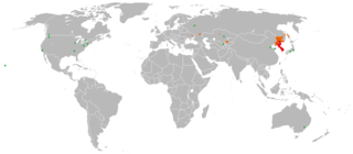
한국어:
한국어 / 조선말의 세계 분포를 나타낸 그림.
English:
The map showing usage of Korean language in the world
日本語:
朝鮮語の世界分布図
中文:
各國家及地區的朝鮮语使用者分布图
Tiếng Việt:
Bản đồ phân bố người sự dụng tiếng Triều Tiên ở các Quốc gia và Vùng lãnh thổ.
|
||
| Source | modified Image:BlankMap-World.png | ||
| Author | created by LERK | ||
|
Permission
( Reusing this file ) |
|
||
| Other versions |
|
