Map_of_Greece,_Archipelago_and_part_of_Anadoli;_Louis_Stanislas_d'Arcy_Delarochette_1791.jpg

Size of this preview:
800 × 561 pixels
.
Other resolutions:
320 × 225 pixels
|
640 × 449 pixels
|
1,024 × 719 pixels
|
1,280 × 898 pixels
|
2,560 × 1,797 pixels
|
9,411 × 6,605 pixels
.
Summary
| Description |
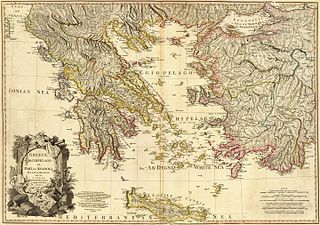
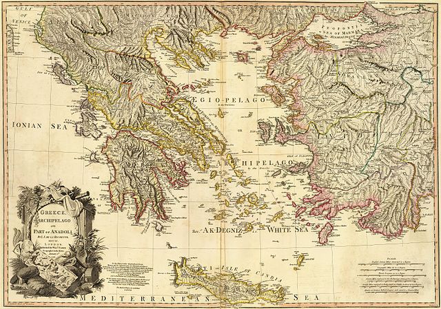
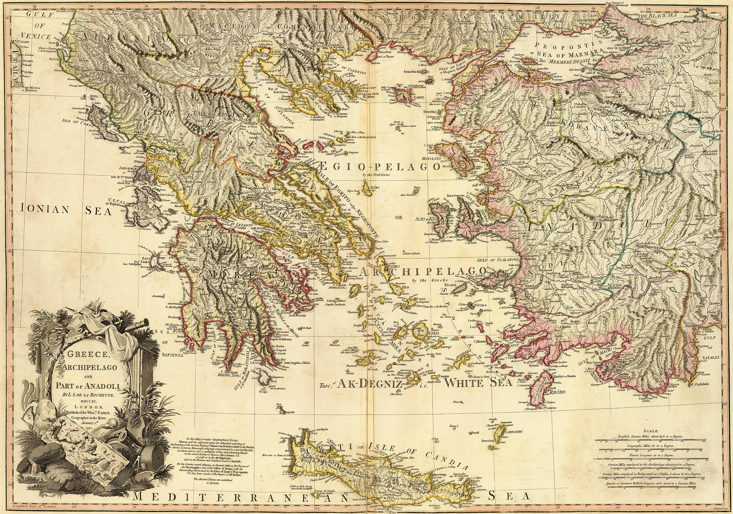
Greece, Archipelago and part of Anadoli. Published for Willm. Faden, Geographer to the King. W. Palmer sculp. . Scale: 1,350,000 |
| Date | |
| Source | http://www.davidrumsey.com/luna/servlet/detail/RUMSEY~8~1~24845~960053?trs=120&mi=23&qvq=mgid%3A2728# |
| Author | Louis Stanislas d'Arcy Delarochette |
| Other versions |
|
.jpg)
.jpg)
.jpg)
Licensing
|
|
This work is in the public domain in its country of origin and other countries and areas where the copyright term is the author's life plus 100 years or fewer . This work is in the public domain in the United States because it was published (or registered with the U.S. Copyright Office ) before January 1, 1929. |
| This file has been identified as being free of known restrictions under copyright law, including all related and neighboring rights. | |
| Warning | The original file is very high-resolution. It might not load properly or could cause your browser to freeze when opened at full size. |
|---|
| Annotations | This image is annotated: View the annotations at Commons |
