ISS-47_Middle_East.jpg
Size of this preview:
800 × 532 pixels
.
Other resolutions:
320 × 213 pixels
|
640 × 426 pixels
|
1,024 × 682 pixels
|
1,280 × 852 pixels
|
2,560 × 1,704 pixels
|
4,928 × 3,280 pixels
.
Summary
| Description |
English:
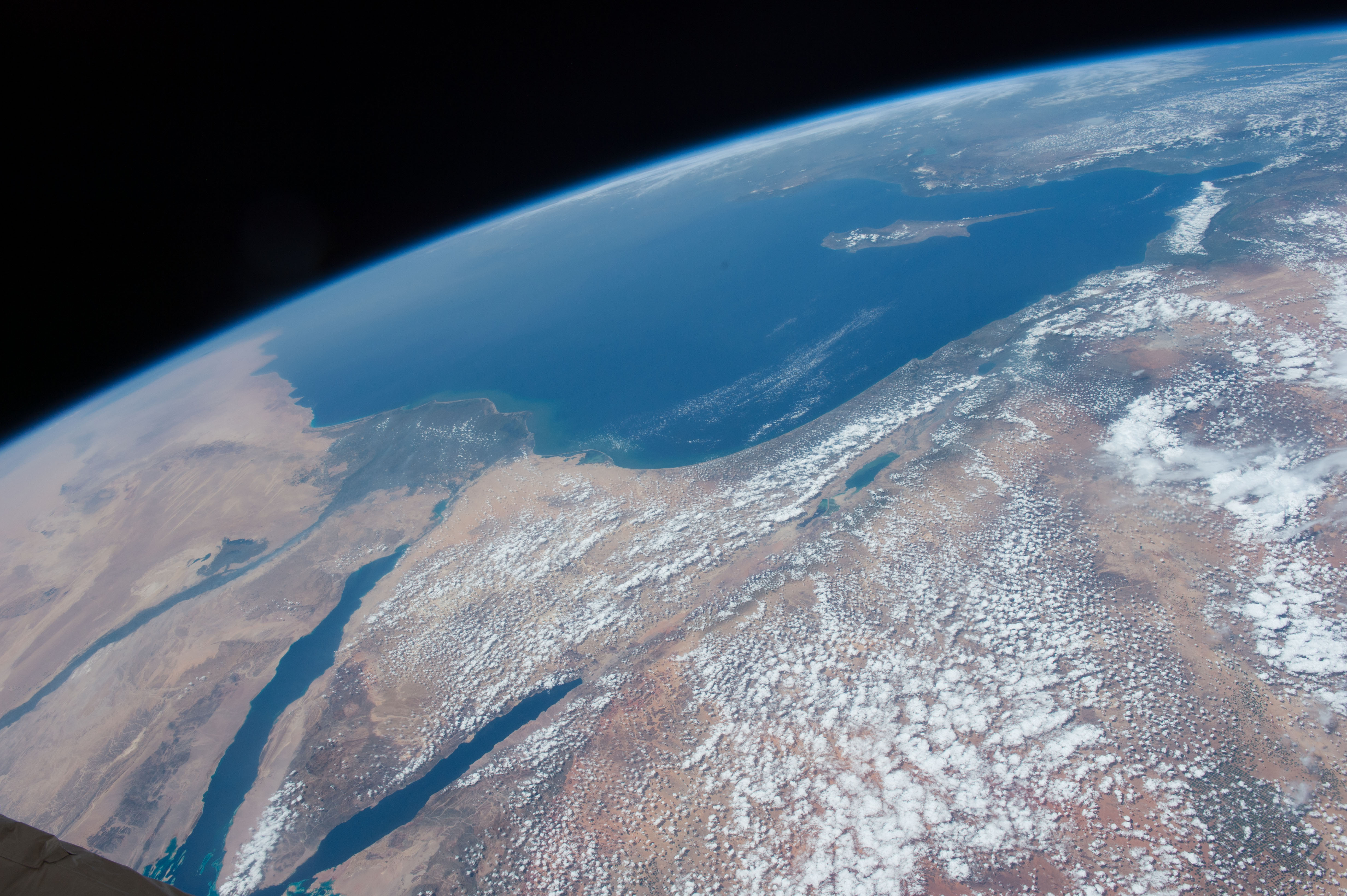
The Middle East is seen from 250 miles above in this photo from the International Space Station. Countries seen left to right along the Mediterranean coast include Egypt, Gaza, Saudi Arabia, Israel, Lebanon, Syria, and Turkey. The major waterways shown from left to right are the Nile River, Gulf of Suez, Gulf of Aqaba, and the Red Sea.
|
| Date | |
| Source | https://www.flickr.com/photos/nasa2explore/26380972471/ |
| Author | NASA |
| Other versions |

|
|
This image or video was catalogued by Johnson Space Center of the United States
National Aeronautics and Space Administration
(NASA) under
Photo ID:
ISS047-E-057822
.
This tag does not indicate the copyright status of the attached work. A normal copyright tag is still required. See Commons:Licensing .
Other languages:
|
Licensing
|
|
This file is in the
public domain
in the United States because it was created by the Image Science & Analysis Laboratory, of the
NASA
Johnson Space Center. NASA copyright policy states that "NASA material is not protected by copyright
unless noted
". (
NASA media use guidelines
or
Conditions of Use of Astronaut Photographs
).
Photo source:
ISS047-E-057822
.
|