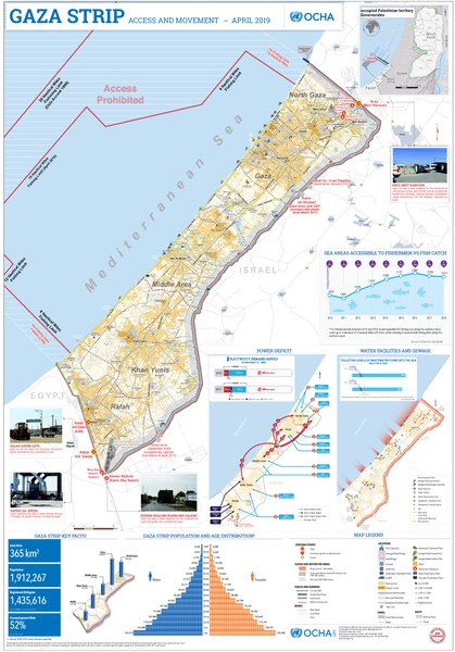
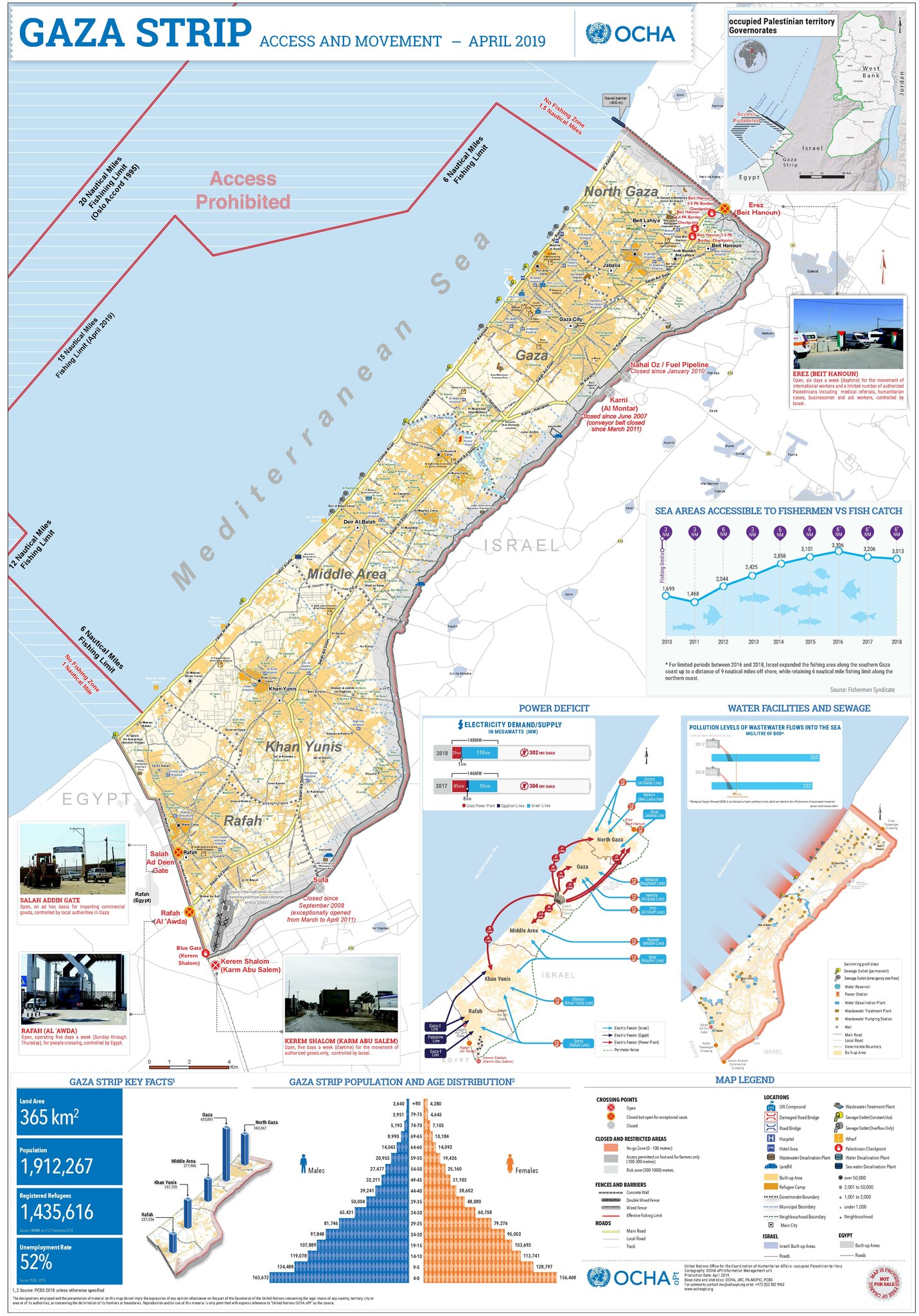
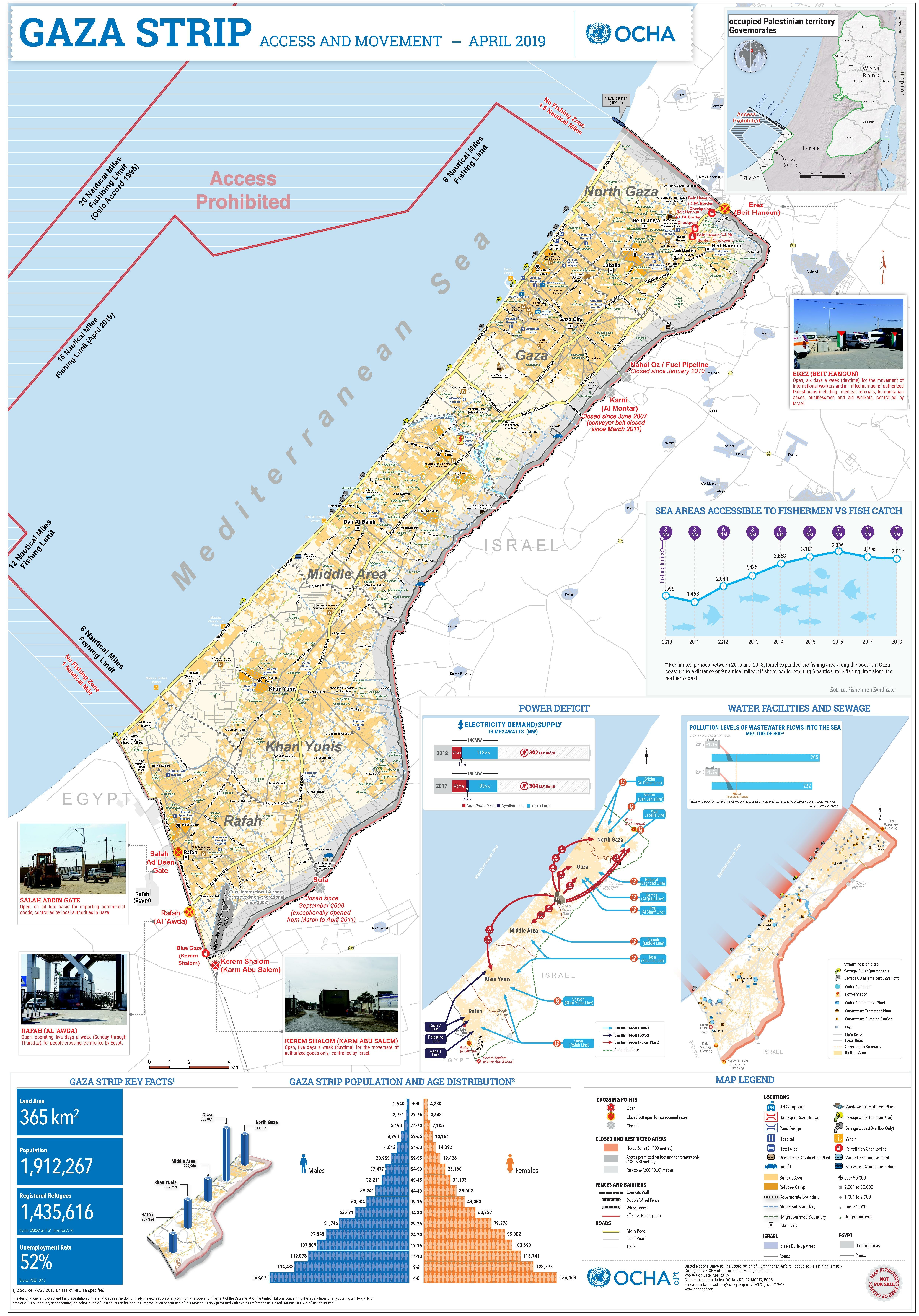
Gaza_Strip_Access_Restrictions.pdf
Size of this JPG preview of this PDF file:
419 × 600 pixels
.
Other resolutions:
168 × 240 pixels
|
335 × 480 pixels
|
536 × 768 pixels
|
715 × 1,024 pixels
|
1,431 × 2,048 pixels
|
4,950 × 7,085 pixels
.
Summary
| Description |
Deutsch:
Gazastreifen mit Zugangsbeschränkungen für seine Bewohner
English:
A map of the Gaza Strip and the access restrictions its residents have
|
|||
| Date | ||||
| Source | https://www.ochaopt.org/sites/default/files/Gaza_A0_2023.pdf | |||
| Author | United Nations Office for the Coordination of Humanitarian Affairs (OCHA) | |||
|
Permission
( Reusing this file ) |
|
