Flickr_-_HuTect_ShOts_-_Citadel_of_Salah_El.Din_and_Masjid_Muhammad_Ali_قلعة_صلاح_الدين_الأيوبي_ومسجد_محمد_علي_-_Cairo_-_Egypt_-_17_04_2010_(4).jpg

Size of this preview:
800 × 489 pixels
.
Other resolutions:
320 × 195 pixels
|
640 × 391 pixels
|
1,024 × 626 pixels
|
1,280 × 782 pixels
|
2,560 × 1,564 pixels
|
3,896 × 2,380 pixels
.
Summary
| Description |
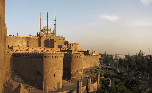
The Saladin Citadel of Cairo (Arabic: قلعة صلاح الدين Qalaʿat Salāḥ ad-Dīn) is a fortification in Cairo, Egypt. The location, part of the Muqattam hill near the center of Cairo, was once famous for its fresh breeze and grand views of the city, and was fortified by the Ayyubid ruler Salah al-Din (Saladin) between 1176 and 1183 AD, to protect it from the Crusaders[1]. Source. en.wikipedia.org/wiki/Cairo_Citadel |
| Date | |
| Source | Citadel of Salah El.Din and Masjid Muhammad Ali قلعة صلاح الدين الأيوبي ومسجد محمد علي / Cairo / Egypt - 17 04 2010 |
| Author | Ahmed Al.Badawy from Cairo, Egypt |
| Camera location |
|
View this and other nearby images on: OpenStreetMap |
|
|---|
.jpg¶ms=030.029522_N_0031.258914_E_globe:Earth_type:camera_source:Flickr_&language=en)
Licensing
This file is licensed under the
Creative Commons
Attribution-Share Alike 2.0 Generic
license.
-
You are free:
- to share – to copy, distribute and transmit the work
- to remix – to adapt the work
-
Under the following conditions:
- attribution – You must give appropriate credit, provide a link to the license, and indicate if changes were made. You may do so in any reasonable manner, but not in any way that suggests the licensor endorses you or your use.
- share alike – If you remix, transform, or build upon the material, you must distribute your contributions under the same or compatible license as the original.
|
|
This image, originally posted to Flickr , was reviewed on 14 August 2010 by the administrator or reviewer Diaa abdelmoneim , who confirmed that it was available on Flickr under the stated license on that date. |